Guaraguao facts for kids
Quick facts for kids
Guaraguao
|
|
|---|---|

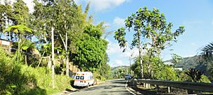
Scene in Barrio Guaraguao at PR-515 Westbound
|
|

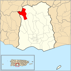
Location of barrio Guaraguao within the municipality of Ponce shown in red
|
|
| Commonwealth | |
| Municipality | |
| Area | |
| • Total | 4.13 sq mi (10.7 km2) |
| • Land | 4.13 sq mi (10.7 km2) |
| • Water | 0 sq mi (0 km2) |
| Elevation | 1,765 ft (538 m) |
| Population
(2010)
|
|
| • Total | 1,117 |
| • Density | 270.5/sq mi (104.4/km2) |
| Source: 2010 Census | |
| Time zone | UTC−4 (AST) |
Guaraguao (also known as Barrio Guaraguao) is one of 31 areas called barrios in the city of Ponce, Puerto Rico. It is one of nine barrios that border other towns. Guaraguao shares its borders with the towns of Adjuntas and Peñuelas.
The name Guaraguao comes from the native Taino Indian language. This barrio was officially created in 1878. Guaraguao is special because it is one of three barrios in Ponce located in the Cordillera Central mountain range. The other two are Barrio Anón and Barrio San Patricio.
Contents
Where is Guaraguao Located?
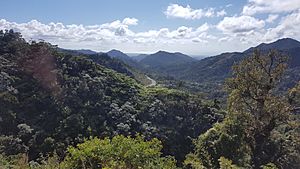
Guaraguao is a rural area with many mountains. It is found in the northwestern part of the municipality of Ponce. Because it's in the mountains, it often gets heavy rains. This can sometimes cause landslides and lead to roads being closed.
The name Guaraguao comes from a tree called Guarea trichilioides. This tree is part of the Guarea ramiflora family. It can grow very tall, from 20 to 70 feet, and its trunk can be up to 3 feet wide. These trees usually grow at the base of mountains in the humid central parts of Puerto Rico.
Guaraguao's Borders
Guaraguao has clear boundaries with other areas.
- To the North, it borders Barrio San Patricio and Barrio Portugues in Adjuntas.
- To the South, it borders Magueyes and Marueño.
- To the West, it borders Marueño and Barrio Rucio in Peñuelas.
- To the East, it borders San Patricio and Tibes.
Facts About Guaraguao
Guaraguao covers about 4.13 square miles (10.7 square kilometers) of land. It does not have any large bodies of water within its borders.
In 2000, about 1,669 people lived in Guaraguao. This meant there were about 130 people for every square mile. It was the seventh least crowded barrio in Ponce at that time.
By 2010, the population had changed to 1,117 people. The population density was about 270.5 people per square mile.
Some important roads that go through Guaraguao include PR-10, PR-123, PR-501, PR-515, and PR-516. There are also smaller communities within Guaraguao, such as Las Lomas and Santas Pascuas. The area known as Sector San Andres is also located here.
The highest point in Guaraguao is 3,280 feet (1,000 meters) above sea level. This high point is located at the very northwestern tip of the barrio.
Nature and Water in Guaraguao
Guaraguao is rich in both fauna (animals) and flora (plants). Many creeks and brooks flow through the area.
The biggest river in Guaraguao is Río Cañas. This river eventually joins with Río Pastillo in Ponce. Together, they form Río Matilde, which then flows into the Caribbean Sea.
In March 2010, the water filtering plant in Guaraguao won an award. It was named the best-tasting water in Puerto Rico! This competition was held by the Puerto Rico Water and Environment Association.
See also
 In Spanish: Guaraguao (Ponce) para niños
- List of communities in Puerto Rico
 | Delilah Pierce |
 | Gordon Parks |
 | Augusta Savage |
 | Charles Ethan Porter |


