Tibes facts for kids
Quick facts for kids
Tibes
|
|
|---|---|

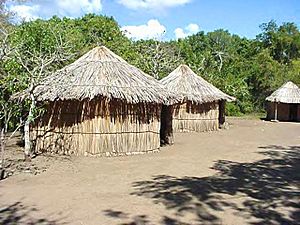
Tibes is home to the Tibes Indigenous Ceremonial Center
|
|

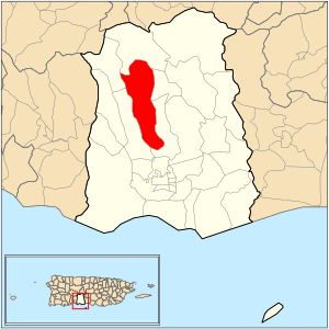
Location of barrio Tibes within the municipality of Ponce shown in red
|
|
| Commonwealth | |
| Municipality | |
| Area | |
| • Total | 6.99 sq mi (18.1 km2) |
| • Land | 6.99 sq mi (18.1 km2) |
| • Water | 0 sq mi (0 km2) |
| Elevation | 1,099 ft (335 m) |
| Population
(2010)
|
|
| • Total | 804 |
| • Density | 115/sq mi (44/km2) |
| Source: 2010 Census | |
| Time zone | UTC−4 (AST) |
Tibes (also known as Barrio Tibes) is one of the 31 areas called barrios in Ponce, Puerto Rico. It's a rural area located in the mountains. Tibes became famous in 1975 when a very old cemetery was found there after some heavy rainstorms. This cemetery turned out to be the oldest ever discovered in the West Indies. The name "Tibes" comes from the native people who lived here long ago. This barrio was officially created in 1831.
Contents
Where is Tibes Located?
Tibes is a mountain barrio found in the middle part of the municipality of Ponce. It sits north of the main city area, at the base of the Cordillera Central mountain range. The name "Tibes" comes from the hard, smooth stones found in the rivers here. These stones were used by the native people as tools or weapons. Local farmers, called jíbaros, also used them to sharpen their farm tools, like the machete.
In September 2017, Hurricane Maria caused a lot of damage in Puerto Rico. Some people living in Tibes were cut off from others for about three months because roads were blocked.
What are the Boundaries of Tibes?
Tibes has clear borders that help define where it is.
- To the north, it's bordered by hills just north of El Principe Road.
- To the south, it's bordered by Tibes Road.
- To the west, it's bordered by hills west of PR-10.
- To the east, it's bordered by Pastillo Road and the hills west of Río Chiquito.
When looking at its neighbors, Tibes shares borders with these other barrios:
- North: Barrio San Patricio
- South: Portugués
- West: Guaraguao and Magueyes
- East: Barrios Monte Llano and Portugués
Facts About Tibes: Land and People
Tibes covers about 6.99 square miles of land. It does not have any large bodies of water like lakes or rivers within its area, though the Río Portugués flows through it.
In 2010, about 804 people lived in Tibes. This means there were about 115 people for every square mile. Tibes is one of the less populated barrios in Ponce. The main roads that go through Tibes are PR-10 and PR-503.
The highest point in Tibes is a place called Cerro del Diablo, which is 2,234 feet tall. Another important land feature is Cerro La Mesa, standing at 1,742 feet.
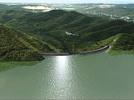
The Portugues Dam
The Portugués Dam is an important structure also found within Barrio Tibes.
See also
 In Spanish: Tibes para niños
- List of communities in Puerto Rico
- Tibes Indigenous Ceremonial Center
 | Claudette Colvin |
 | Myrlie Evers-Williams |
 | Alberta Odell Jones |


