
Toro Negro State Forest facts for kids
Quick facts for kids Toro Negro State ForestSpanish: Bosque Estatal de Toro Negro |
|
|---|---|

Bosque Estatal de Toro Negro shown in the foreground
|
|
| Map | |

Location in Puerto Rico
|
|
| Geography | |
| Location | PR-143, km. 32.4 and PR-149 km 39.0, Ponce/Jayuya/Orocovis/Ciales/Juana Diaz, Puerto Rico |
| Coordinates | 18°10′24″N 66°29′32″W / 18.17342°N 66.49231°W |
| Elevation | 4,390 feet (1,340 m) |
| Area | 8,204 cuerdas (7,968 acres) (32.24 km2) |
| Administration | |
| Status | Public, Commonwealth |
| Established | 1934 with 6,800 acres |
| Visitation | 126,916 (2008) |
| Events | Cerro Maravilla murders |
| Governing body | Puerto Rico DRNA |
| Ecology | |
| Ecosystem(s) | Subtropical Moist Zone (31% of the forest): -Tabonuco forest. Lower Mountain Wet Zone (69% of the forest): -Micropholis Buchenavia forest, -Mountain palm forest, -Cloud forest. |
| WWF Classification | Puerto Rican moist forests |
| Disturbance | -Hurricanes and Landslides |
| Forest cover | 81% - 99% |
| Dominant tree species | Melastomaceae (16 species), Lauraceae (11 species), Myrtaceae (10 species) |
| Indicator plants | Tabonuco (Dacryodes excelsa), Ausubo (Manilkara bidentata), Montillo (Sloanea berteroana) |
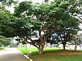
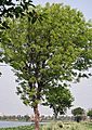
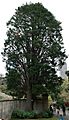
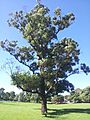
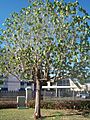
The Toro Negro State Forest (Spanish: Bosque Estatal de Toro Negro) is one of Puerto Rico's 21 public forests. It is known for being Puerto Rico's highest cloud forest. This amazing forest is located in the Central Mountain Range of the island. It covers about 8,204 acres (32.24 square kilometers) of mountains.
Toro Negro is home to some of the island's tallest peaks, including Cerro de Punta, Cerro Jayuya, and Cerro Rosa. You can also find Lake Guineo here, which is the highest lake in Puerto Rico. The forest offers 18 kilometers (11 miles) of trails, a tall observation tower, two natural swimming pools called "charcos", and areas for camping and picnics. Many rivers, creeks, and waterfalls flow through the forest. Toro Negro State Forest spreads across parts of Ponce, Jayuya, Orocovis, Ciales, and Juana Díaz. It is made up of seven separate areas of land. The largest part of the forest is in Ponce and Jayuya. About 40% of the forest is in Ponce's Barrio Anón.
The forest was first created in 1935 as part of the Caribbean National Forest. It was managed by the U.S. government until 1970. In 1970, the U.S. government gave the Toro Negro section to the Government of Puerto Rico. In return, Puerto Rico gave some of its forest lands near Luquillo National Forest to the U.S. government. This exchange helped create the El Yunque National Forest we know today. After this, the Puerto Rico Department of Natural and Environmental Resources (DRNA) took over. They opened the Toro Negro Forest Reserve as a state forest and renamed it Bosque Estatal de Toro Negro.
Contents
- Forest History
- Protecting the Forest
- Where is Toro Negro Located?
- Forest Types
- Forest Geology
- Plants of Toro Negro
- Animals of Toro Negro
- Forest Facilities
- Nearby Attractions
- Forest Climate
- Images for kids
- See also
Forest History
.jpg)
In 1876, King Alfonso XII of Spain announced the first plans to create forest reserves in Puerto Rico. The land where Toro Negro is now was once used for growing coffee. However, in the 1930s, a program began to plant new trees and bring the forest back to life.
In 1934, the Puerto Rico Reconstruction Administration (PRRA) bought these lands. The forest started with about 2,733 hectares (6,753 acres) in 1934. In 1935, the PRRA bought another 1,900 acres of private land. At first, Toro Negro was not a separate forest. It was part of the Caribbean National Forest and was managed by the U.S. Forest Service. More land was added, bringing the total size of Toro Negro to 6,620 acres that year. Between 1934 and 1945, over 3 million young trees and about 19,000 pounds of seeds were planted on 1,856 acres of the forest. Twenty-eight different types of trees were planted in various areas.

In 1942, the U.S. Department of the Interior gave the forest to the United States Department of Agriculture. From 1942 to 1961, the U.S. Forest Service managed it. During these years, the U.S. Department of Agriculture continued to buy more land for Toro Negro.
In 1961, Toro Negro was given to the Government of Puerto Rico. The official transfer happened on May 21, 1962. The 6,817 acres of land that made up the Toro Negro Unit of the Caribbean National Forest were given to Puerto Rico. Some of this land was exchanged for other lands near the Luquillo Unit of the Caribbean National Forest. The rest of the land was given to Puerto Rico's Department of Agriculture for forestry. This led to the creation of the Toro Negro State Forest. Since 1962, about 120 cuerdas (a unit of land measurement) have been planted with trees like eucalyptus, mahoe, kadam, and Honduran pine. In 1962, Toro Negro had 6,817 acres, which was about 11.32% of Puerto Rico's state forests. The Doña Juana Recreational Area was added to Toro Negro in 1962. In April 1970, another land exchange happened. The Puerto Rico Department of Agriculture bought and transferred 1,677 acres of forest lands next to the Luquillo Experimental Forest. In return, the entire Toro Negro forest was fully transferred to Puerto Rico.
The lower parts of Toro Negro used to be important coffee farms. However, the whole forest is now very important for protecting water and soil. Today, between 81% and 99% of the forest is covered by trees. The forest was named after the Río Toro Negro, one of nine rivers that flow from it. This river is also the name of a barrio (neighborhood) in the Ciales part of the forest.
Protecting the Forest
| Protected Areas at Bosque Estatal de Toro Negro | |
|---|---|
|
IUCN Category IV (Habitat/Species Management Area)
|
|
| Location | Puerto Rico Ponce (Approx 40%), Jayuya (Approx 30%), Orocovis (Approx 15%), Ciales (Approx 10%), and Juana Diaz (Approx 5%) |
| Nearest city | Ponce |
| Area | 7,967.6 acres (3,224.4 ha) |
| Established | 1934 |
| Visitors | 126,916 (in 2008) |
| Governing body | Puerto Rico DRNA |
Toro Negro is a protected area by law. It has a "IV" protection status from the International Union for the Conservation of Nature (IUCN). This means it's a "Protected Area with sustainable use of natural resources." The Puerto Rico Department of Natural and Environmental Resources manages and protects the forest's environment.
When the federal government bought land for the reserve in 1935, people already living there were allowed to stay. This was part of a program called parcelero.
In 1999, there was a plan to make the protected area bigger. This plan aimed to connect Toro Negro with the Guilarte and Pueblo de Adjuntas State Forests. In 2008, the U.S. Department of Agriculture called Toro Negro State Forest a "Status 2" forest. This means it has lasting protection from being turned into other types of land. It also has a plan to keep it mostly natural. However, some activities might still affect its natural communities. As of 2013, there were efforts to buy more land next to Toro Negro State Forest from private owners. The goal was to make the protected area larger. They also wanted to create a wildlife corridor. This corridor would connect Toro Negro with the nearby Tres Picachos and Guilarte state forests.
Where is Toro Negro Located?
Toro Negro is in the central mountains of Puerto Rico. It covers a total area of about 8,203.7 acres (33.2 square kilometers). The forest office is located at kilometer 32.4 on Route PR-143. This is east of the intersection with Route PR-149. The forest ranger's office and visitors' area are on Puerto Rico Highway 143 Km 32.4. This spot is in Barrio Ala de la Piedra, Orocovis.
The largest parts of the forest are in Ponce and Jayuya. Both of these towns are in the Porta Caribe tourism zone. Cerro de Punta, Puerto Rico's highest peak at 1,338 meters (4,390 feet), is in the western part of the forest. The lowest point in the forest is near Salto de Inabón (Inabón Falls). This area is about 440 meters (1,444 feet) above sea level.
Forest Types


Toro Negro has four main types of plant groups. These are found in two main climate zones. The first zone is the subtropical moist forest (31% of the forest). The second is the lower mountain wet forest (the other 69%). The land has many steep slopes and tall waterfalls. The different forest types in Toro Negro are named based on their height and what grows there. From Cerro Maravilla, one of the tallest peaks, you can see four distinct forest types: Bosque Tabonuco, Bosque Micropholis Buchenavia, Bosque Sierra de Palmas, and Bosque enano (dwarf forest).
Tabonuco Forest
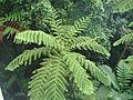
At the lower parts of the forest, below 2,000 feet (610 meters) above sea level, you'll find the Tabonuco forest. This forest is mostly made up of the tall Tabonuco tree (Dacryodes excelsa). These trees can grow up to 100 feet (30 meters) tall. They grow best in protected spots at lower heights. The Tabonuco forest looks a lot like a tropical rainforest. It has three layers of tree tops: a high layer, a lower layer, and a layer of smaller plants underneath. The Tabonuco tree makes up about 35% of the top layer. The second most common tree here is the Montillo (Sloanea berteroana). It has large roots that spread out, which is common for big rainforest trees. These roots help support the heavy tops of large trees growing in very wet soil. The ground in this forest has very few plants. However, the tree tops are full of air plants like bromeliads, orchids, vines, and tree ferns. The Tabonuco forest is the main type in the subtropical wet climate zone.
Above 2,000 feet (610 meters), you will find the Micropholis Buchenavia forest. The trees in this forest are shorter, usually less than 50 feet (15 meters) tall. The layers of tree tops are not as clear as in the Tabonuco forest. Micropholis and Buchenavia (Granadillo) are the main types of trees in this lower mountain forest.
Sierra de Palmas Forest
At about the same height as the Micropholis Buchenavia forest (above 2,000 feet or 610 meters), but on very steep slopes, are the Sierra de Palmas forests. These forests are mostly made up of the sierra palm (Prestoea montana). This type of forest can reach 50 feet (15 meters) in height. The Sierra de Palmas covers the largest area of all forest types in Toro Negro. You can easily spot the palm forest from far away by the shape and size of its leaves. Also, its leaves have a light green color. At lower heights (below 650 meters or 2,133 feet), you see palms spread out. But at higher heights, the sierra palm becomes the main tree over a large area. The trunk of the sierra palm is straight and tall, growing 10-15 meters (33-49 feet) high. Its long leaves are usually 2.0-2.5 meters (6.6-8.2 feet) long. They create a thick shade on the ground. The palm forest usually has only one main type of tree. It is normally open and does not have many small plants growing underneath. The round fruits are a bit more than one centimeter (0.4 inches) across and grow in large numbers.
Dwarf or Cloud Forest
At the highest points, near the top of Cerro de Punta, Cerro Maravilla, and other peaks, you'll find the Bosque enano forest. This is also called dwarf forest or moss forest. This forest type has very thick groups of small, stunted trees and shrubs. The cloud forest has many of the same tree types as the Micropholis Buchenavia forest. However, their growth is limited by harsh weather. This includes heavy rain, strong winds, and almost constant cloud cover.
The dwarf or cloud forest in the Central Mountain Range looks different from the cloud forest in the Sierra Luquillo Mountains. This is because the environment in Toro Negro is not as harsh. The wind's effect is much less here. The shrubs are not bent or cut to an even surface. Instead, they stand upright, and their tops are rounded and uneven. The mosses are just a thin layer on the more protected tree trunks. In many places, there is no moss at all. The large mats of Selaginella are completely missing.
In the Toro Negro forest, only the most difficult-to-reach mountain tops have never been cleared. Most of the lower areas have been used for logging, clearing, burning, and grazing. They have also been used for farming for a long time. Most of the forest lands in Toro Negro are higher than where coffee can be grown well.
Forest Geology
Toro Negro State Forest has both deep and surface soils. The deep soils come from volcanic igneous rock. These soils are fine-grained and contain a lot of permeable clay. They have small amounts of sand and silt. They also have high amounts of iron and aluminum, but little silica. The surface soils are acidic and break easily. The subsoil is acidic and heavy, but water can pass through it. The hills in the forest are mostly steep. Often, the top soil is lost due to erosion.
Nine rivers flow south from the forest: Río Indalecia, Río Guayo, Río Inabón, Río Blanco, Río Anón, and Río Prieto. Three rivers flow north: Río Saliente, Río Toro Negro, and Río Matrullas. The Matrullas and Guineo reservoirs are also part of the forest. The Río Toro Negro, which the forest is named after, separates the towns of Ciales and Orocovis. It also forms Lago El Guineo. The forest's other lake, Lago Matrullas, can be reached by Puerto Rico Highway 564. This highway is accessed via PR-143, in Orocovis.
Plants of Toro Negro
| Fauna and Flora at Bosque Estatal de Toro Negro | |
|---|---|
|
IUCN Category IV (Habitat/Species Management Area)
|
|
| Location | Ponce, Ponce / Jayuya / Orocovis / Ciales / Juana Diaz, Puerto Rico |
| Area | 6,945 acres (28.11 km2) |
| Elevation | 4,390 ft (1,340 m)Highest peak in Puerto Rico |
| Established | 1934 |
| Named for | Toro Negro River |
| Visitors | 126,916(67% island residents and 33% international visitors) |
| Governing body | Puerto Rico Department of Natural and Environmental Resources |
| Website | Toro Negro State Forest |
Toro Negro has four main plant groups found in two moist climate zones. The first is the Subtropical Moist Zone, which includes the Tabonuco forest. The second is the Lower Mountain Wet Zone. This zone has three sub-forests: the Micropholis Buchenavia forest, the Mountain Palm forest, and the Dwarf forest.
Experts E. L. Little and F. H. Wadsworth found 160 tree species from 53 families in the forest. The largest families are Melastomaceae (16 species), Lauraceae (11 species), and Myrtaceae (10 species).
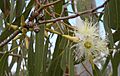
Ferns and orchids are very common here. Forty of the plant species in this forest are found only in Puerto Rico (endemic). Thirteen species were brought from other places. The fern Thelypteris inabonensis is found only in this forest. It grows at the start of the Rio Inabon and at Toro Negro's Cerro Rosa in Ciales. The U.S. Fish and Wildlife Service has listed it as an endangered species.
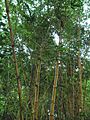
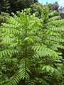
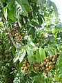
Some common trees include: tabonuco (Dacryodes excelsa), ausubo (Manilkara bidentata), jagüilla (Magnolia portoricensis), nuez moscada (Ocotea moschata), granadillo (Buchenavia capitata), maga (Montezuma speciosissima), higüerillo (Vitex divaricata), almedrón (Prunus occidentalis), and jácana (Pouteria multiflora). Also, Palmas de sierra (Prestoea montana) and helechos arbóreos (Cyathea Sp.) are very common. Some trees brought to this forest are mahoe (Hibiscus elatus Sw.), Honduran mahogany (Swietenia macrophylla), Honduran pine (Pinus caribaea), eucalyptus (Eucalyptus robusta), and kadam (Anthocephalus chinensis).
Ilex cookii, also known as Cook's Holly, is a small evergreen holly shrub. It is found only in the Toro Negro State Forest and is very rare. The IUCN lists it as a critically endangered species. It is protected by law.
Between 1935 and 1943, 28 types of trees were planted in Toro Negro. These included both native and non-native species.
Animals of Toro Negro

There are 30 types of birds reported in the forest. Six of these birds are found only in Puerto Rico. Two bird species are endangered: the Puerto Rican sharp-shinned hawk (Falcón de sierra; Accipiter striatus venator) and the Puerto Rican broad-winged hawk (Guaragüao de bosque; Buteo platypterus brunnescens). The Puerto Rican parrot (Cotorra puertorriqueña; Amazona vittata), which is critically endangered, has also been seen here.
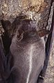
Recent studies have found eight species of bats. You can often see them at dusk when they come out to hunt for food, mostly mosquitoes. The 13 types of bats living in the forest help control mosquitoes. Mosquitoes can carry diseases and bother hikers. The three most common bat species are the greater bulldog bat, Antillean ghost-faced bat, and the sooty mustached bat.
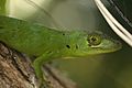
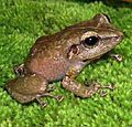
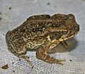
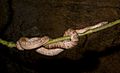
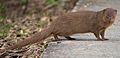
There are 20 species of reptiles and amphibians. All of them, except for the Bufo marinus (Sapo común), are found only in Puerto Rico. Reptiles include the Lagarto verde (Anolis cuvieri), lagartijo pigmeo (Anolis occultus), and the boa de Puerto Rico (Chilabothrus inornatus). The Puerto Rican boa is in danger of disappearing. Amphibians include the siguana (Ameiva exsul) and the culebra ciega (Amphisbaena caeca). Amphibians also include the coquí común (Eleutherodactylus coqui) and the coquí de la montaña (Eleutherodactylus portoricensis). The mountain coquí is considered vulnerable under Puerto Rico Law 6766. The Small Asian mongoose (Mangosta pequeña asiática; Herpestes javanicus) has also been seen in this forest.
Toro Negro State Forest is home to 11 types of snakes. None of them are venomous to humans. The Puerto Rican boa (Chilabothrus inornatus) can grow to 6-7 feet (1.8-2.1 meters) long and weigh about 2 pounds (0.9 kg). It is a thick snake with a tan to dark brown body and dark spots on its back. It will bite to defend itself, but it kills its prey by squeezing it. This snake is a protected species because too many were hunted for their oil and skins. It is active at night and prefers to stay hidden during the day. The Puerto Rican racer (Culebra Corredora; Alsophis portoricensis) grows to 3 feet (0.9 meters). It moves through the trees of the Toro Negro Forest. Its body is solid brown, with each scale outlined by a darker brown. Like other garden snakes in the forest, it hunts during the day. The forest also has blind snakes. They spend almost their whole lives underground. Sometimes they hide under rotting trees. They do not bite because they do not have teeth.
_(English%3DSirajo_Goby)_(Taxonomy%3DSicydium_plumieri).jpg)
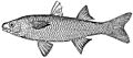
The rivers and lakes in the forest are home to several types of fish and crustaceans. Fish found here include Dajao (Mountain Mullet; Agonostomus monticola) and Olivo (Sicydium plumieri), also known as Ceti. Some crustaceans are the camarón bocu (Macrobrachium crenulatum), gata (Atya lanipes), and buruquena (Epilobocera sinuatifrons). All of these crustaceans are found only in Puerto Rico.
Forest Facilities
Most of the forest's facilities are in Orocovis. They are known as the Doña Juana Recreational Area. The only exception is the Salto de Doña Juana waterfall, which is nearby but not inside the forest. You can take guided tours or explore on your own. Ziplining is also a popular activity here. The forest office has staff from the Puerto Rico Department of Natural and Environmental Resources. They provide maps, weather info, and warnings about mudslides. Toro Negro has a camping area, a recreational area, hiking trails, and observation points.
Hiking Trails
There are 10 official hiking trails that cover 18 kilometers (11 miles). These trails are great for hiking, bird watching, enjoying the views, and relaxing. While there are 10 official trails, some are actually dirt roads for park ranger vehicles. Also, some "trails" require you to walk on a paved road. The trails are usually wide. However, since the forest is in the mountains with high humidity and rain, many trails can be muddy. Hikers often use walking sticks to help them balance on slippery surfaces, especially on rocks covered with algae. Some trails lead to or pass by "charcos" (natural swimming pools). The Toro Negro State Forest office is where several trails begin. However, most trails are not well marked or maintained. This can make them hard to find and follow in the thick forest. The municipality of Orocovis is in charge of trail maintenance.
| No. | Trail Name | Features | Description | Approx length |
Notes | Northern Terminus | Southern Terminus |
|---|---|---|---|---|---|---|---|
| 1 | Camino El Bolo | Longest trail; a loop over Cerro El Bolo; Connects to PR-561 | 3.0 miles (4.8 km) | Connects to trails # 3 and #6 | PR-143, Northeast of the Visitors Center | Visitors Center, PR-143, Km 32.4 | |
| 2 | Camino Ortolaza | --- | Closed | --- | Closed | Closed | Closed |
| 3 | Camino to Observation Tower | Tower altitude: 3,537 ft above sea level. Hike to the top of Cerro Doña Juana | 0.60 miles (0.97 km) | One way trail; Very slippery slopes | Observation Tower | Trail #1 | |
| 4 | Camino Vega Grande | --- | Closed | --- | Closed | Closed | Closed |
| 5 | Camino Las Cuarenta | Second longest trail (2.95 mi), if hikes on State Roads PR-564 and PR-143 are included | 0.90 miles (1.45 km) | Poorly maintained | PR-564, Water Pumping Station | Trail #8 | |
| 6 | Camino to Pool | Pool and Picnic areas | 0.80 miles (1.29 km) | Well maintained; Pool open during summer months only | PR-143 | Trail #1 | |
| 7 | Camino to Area de Acampar | Camping Area | 0.10 miles (0.16 km) | Paved road to the camping/picnic area | Camping Area | Visitors' Center, PR-143, Km 32.4 | |
| 8 | Camino to Charco La Confesora | La Confesora Pond | 0.54 miles (0.87 km) | Small Waterfall and Pool of deep pristine blue water | Charco La Confesora | Trail #7, Camping Area | |
| 9 | Camino Doña Petra | Connects to State Road PR-564 | 0.40 miles (0.64 km) | Muddy Trail | PR-564 | Bridge at Camping Area | |
| 10 | Camino El Tabonuco | --- | Closed | --- | Closed | Closed | Closed |
| 11 | T9-to-T5 Connector | --- | Closed | --- | Closed | Closed | Closed |
Key to icons:
![]() – Indicates a Hiking trail area
– Indicates a Hiking trail area
![]() – Indicates Camping area
– Indicates Camping area
![]() – Indicates a Picnic area
– Indicates a Picnic area
![]() – Indicates Diving or Snorkeling area
– Indicates Diving or Snorkeling area
![]() – Indicates Fishing area
– Indicates Fishing area
![]() – Indicates Swimming area
– Indicates Swimming area
![]() – Indicates a Lookout tower
– Indicates a Lookout tower
![]() – Indicates Visitors' Center
– Indicates Visitors' Center
Trail #1: El Bolo Loop
Camino El Bolo is the forest's longest trail, about 2 miles (3.2 km) long. It's mostly a loop around Cerro El Bolo. This trail goes along Cerro El Bolo (El Bolo Mountain), Puerto Rico's tenth tallest peak. It's 3,527 feet (1,075 meters) above sea level. This trail is not too difficult. It starts at the visitors' parking area on PR-143 and ends on PR-143. From there, hikers can walk back to the parking area. The trail starts with a steep climb. About 0.4 miles (0.6 km) in, it flattens out and becomes rocky, then grassy. Another 0.4 miles (0.6 km) east, the trail connects to Trail #6, which leads to the swimming pool. The trail then goes uphill again for 0.2 miles (0.3 km). It connects to a paved road, Puerto Rico Highway 561. From this point, the trail goes downhill north-northwest for about 0.8 miles (1.3 km). It reaches paved road PR-143, near kilometer 32.6. From here, hikers turn left to walk southwest on PR-143 until they reach the visitors' area at kilometer 32.4.
Trail #3: Observation Tower Hike
This trail leads to the Observation Tower. It is for more experienced hikers. Trail #3 does not start at the visitors' parking area. You must hike on other trails first to reach it. From the parking area, there are three ways to get to Trail #3. The shortest way is to walk northeast on PR-143 for about 0.25 miles (0.4 km). Then, turn right into the forest at the sign for "Verada #6 - Piscina" to get on Trail #6. Hike 0.8 miles (1.3 km) on Trail #6 to its end. Then, turn left onto Trail #1 and hike about 0.3 miles (0.5 km) to the start of Trail #3.
Once on Trail #3, hikers climb about 0.6 miles (1 km) to the top where the observation tower is. The trail to the observation tower is very steep and slippery. It is a one-way trail, meaning you use the same path to go back down. Going downhill can feel even more slippery. This trail is made of rocks, but because of the high humidity and low traffic, algae have grown on the rocks, making them very slick. Walking around the rocks doesn't always help, as the area is muddy. The view, fresh air, and breeze at the top make the hike worthwhile. You can see panoramic 360° views. The tower is 3,537 feet (1,078 meters) above sea level. The total distance from the visitors' parking area to the tower is 2.14 miles (3.4 km).
Trail #5: Las Cuarenta Trek
Trail #5 is about 0.9 miles (1.4 km) long and is a medium difficulty trail. It can be quite muddy, especially outside the dry season (December-March and June-July). To reach this trail from the visitors' parking area, first walk north on Trail #7 (the Camping Area trail, 0.1 miles or 0.16 km long). Cross the bridge over the Doña Juana Creek, then get on Trail #8. From Trail #8, walk west for about 0.2 miles (0.3 km) to find the entrance to Trail #5 on your right. The trail heads north and leads to Puerto Rico Highway 564. The first part of the trail goes downhill for 0.9 miles (1.4 km).
The trail goes through a thick tropical jungle with banana trees, sierra palms, tree ferns, flamboyant trees, and elephant ears. It is muddy, steep, and not well marked. It can be hard to see through the dense plants. There are several creeks near this trail, and many birds can be seen. These include black-throated blue warblers, northern parulas, green mangos, Cape May warblers, and belted kingfishers. After 0.9 miles (1.4 km), the trail reaches PR-564. There is a water pumping station on the left. From this point, the "trail" turns right, as PR-564 is part of the route. Walk south on PR-564 for 0.6 miles (1 km) to find the start of Trail #9 (the Doña Petra trail) on the right. Continue south on PR-564 for another 0.1 miles (0.16 km) until it meets PR-143. Turn right onto PR-143 and continue south on Trail #5. Walk another 0.25 miles (0.4 km) to reach the visitors' parking area on the right. Including the walks on Trails #7 and #8, plus roads PR-564 and PR-143, Trail #5 is 2.95 miles (4.7 km) long. This makes it the second longest hike in Toro Negro.
Trail #6: The Pool Trail
This trail is about 0.5 miles (0.8 km) long and is an easy hike. The trail is well kept, but the natural pool it leads to is only open during summer months. To start from the visitors' parking area, walk northeast on PR-143 (turn left from the parking area) for about 0.25 miles (0.4 km). Then, turn right into the forest at the sign that says "Verada #6 - Piscina" to get on Trail #6. This trail follows a river for about 0.25 miles (0.4 km) before you see a sign for "Piscina" pointing left. As you continue south on the trail, you'll see two beautiful waterfalls. Further uphill and southbound, the trail goes through two flat, open areas with picnic tables. After this, the trail continues uphill and southbound for about 0.6 miles (1 km) until it ends at Trail #1. Once you reach Trail #1, you can turn left or right to continue on Trail #1 (which is a loop trail), or you can turn around and go back to the parking area using Trail #6. The entire length of Trail #6 is 0.8 miles (1.3 km).
Trail #7: Camping Area Access
This trail is actually a paved forest road that leads to the Los Viveros camping area. This is the only campground in Toro Negro State Forest. It is located north of the parking area. The "trail" is only 0.1 miles (0.16 km) long, wide, and flat, making it an easy walk. This trail also connects to Trail #8, which leads to Charco La Confesora. Another use for this trail is that it leads to one of the forest's three official picnic areas. This picnic area is the closest one to the visitors' parking area. The Doña Juana Creek runs next to the picnic area.
Trail #8: Charco La Confesora
This trail is 0.54 miles (0.87 km) long and is a medium difficulty trail. It leads to El Charco ("The Pond"), a natural swimming hole. It is located north of the parking area and starts at the end of Trail #7. After walking north from the parking area on Trail #7 (a 0.1-mile paved road), and passing the camping area, Trail #7 ends at the Doña Juana Creek. There is a sign pointing west (Charco Confesora) near the picnic area that helps you find it. At this point, hikers walk over a small bridge to cross the creek, where Trail #8 begins. The trail heads northwest along the creek (the creek is on the left side of the trail). The trail is full of wild flowers. It is a downhill trail and a bit muddy. A part of the trail has concrete steps. At the end of the trail is Charco La Confesora, a natural "pool" with a waterfall behind it. Swimming is allowed at this charco. The way back is the same as the way to the charco, as the trail ends there.
Trail #9: Doña Petra Path
This trail is 0.4 miles (0.64 km) long and is a medium difficulty trail. Like Trail #5, it is located north of the parking area and starts where Trail #7 ends. Also like Trail #5, this trail can be quite muddy, especially outside the dry season (December-March and June-July). To reach this trail from the visitors' parking area, first walk north on Trail #7 (the Camping Area trail, 0.1 miles or 0.16 km long) and cross the bridge over the Doña Juana Creek. Trail #9 begins at this bridge. If you go left from the bridge, you'll be on Trail #8. But if you go straight (northbound), you'll get onto Trail #9, the Doña Petra Trail. (Like Trail #5, this trail will also lead you to State Route PR-564, but since it's shorter, it doesn't go as far north as Trail #5.) The first part of the trail goes downhill for 0.2 miles (0.3 km). According to ranger maps, there used to be a trail to the left (westbound) that connected to Trail #5. However, plants have grown over it, so it's no longer visible. The trail then continues another 0.2 miles (0.3 km) until it reaches PR-564. From this point, the "trail" turns right, as PR-564 is meant to be part of the trail. Hikers walk south on PR-564 for 0.1 miles (0.16 km) until the "road trail" meets PR-143. At State Route PR-143, hikers turn right to continue south on Trail #9. From this point, hikers walk another 0.25 miles (0.4 km) to arrive at the visitors' parking area on the right side of the road. Including the walk on Trail #7 and roads PR-564 and PR-143, Trail #9 is 0.75 miles (1.2 km) long.
Closed Trails: #2, #4, #10, and #11
Trails #2, #4, and #10 are no longer active. Trail #2 was called Camino Ortolaza and was 0.5 miles (0.8 km) long. It was a "one-way" trail, meaning it had the same entrance and exit. It ran from PR-143 to the Doña Juana Creek. It started on PR-143 about 0.25 miles (0.4 km) west of the entrance to the Recreational Area/visitors' parking area. It headed north and ended at the Doña Juana Creek, about 0.2 miles (0.3 km) west of Charco La Confesora. Trail #4 was called Camino Vega Grande and was 0.4 miles (0.6 km) long. It was also a "one-way" trail and started on PR-143 about 0.1 miles (0.16 km) east of where the current Trail #1 ends on the east side. Trail #10 was called Camino El Tabonuco and was about 0.2 miles (0.3 km) long. It was also a "one-way" trail. It started at kilometer 32.3 on PR-143 and went north into the forest.
An unnamed trail, sometimes called Trail #11, is also closed. It was located halfway on Trail #9 (about 0.2 miles or 0.3 km west of PR-546) and went north to Trail #5. This trail was about 0.3 miles (0.5 km) long. It was a nature trail and also a shortcut from Trail #5 back to the parking area via Trail #9. The DRNA considers this unnamed trail part of Trail #5.
Camping Areas
| Highest peaks at Toro Negro | |
|---|---|
|
|
|
| Monte Jayuya – 2nd highest at Toro Negro | |
| Highest point | |
| Elevation | 1,296 m (4,252 ft) |
| Prominence | 2nd highest peak in Puerto Rico |
| Geography | |
| Location | Ponce & Jayuya |
| Parent range | Cordillera Central |
| Climbing | |
| Easiest route | PR-143, km 18.2 |
| Cerro Rosa – 3rd highest at Toro Negro | |
| Highest point | |
| Elevation | 1,263 m (4,144 ft) |
| Prominence | 3rd highest peak in Puerto Rico |
| Geography | |
| Location | Ciales & Jayuya |
| Parent range | Cordillera Central |
| Climbing | |
| Easiest route | End of PR-539 South, then Hike |
| Cerro Maravilla – 4th highest at Toro Negro | |
| Highest point | |
| Elevation | 1,205 m (3,953 ft) |
| Prominence | 5th highest peak in Puerto Rico Site of Cerro Maravilla murders |
| Geography | |
| Location | Ponce, Puerto Rico |
| Parent range | Cordillera Central |
| Climbing | |
| Easiest route | PR-577, km 0.5 |
| Cerro El Bolo – 5th highest at Toro Negro | |
| Highest point | |
| Elevation | 1,075 m (3,527 ft) |
| Prominence | 10th highest peak in Puerto Rico |
| Geography | |
| Location | Villalba, Puerto Rico |
| Parent range | Cordillera Central |
| Climbing | |
| Easiest route | PR-143, km 32.4 |
| Cerro Doña Juana – 6th highest at Bosque Estatal de Toro Negro | |
| Highest point | |
| Elevation | 1,058 m (3,471 ft) |
| Prominence | 12th highest peak in Puerto Rico |
| Geography | |
| Location | Orocovis, Puerto Rico |
| Parent range | Cordillera Central |
| Climbing | |
| Easiest route | PR-143, km 32.4 |
The campground at Toro Negro is called Los Viveros. It is located on PR-143, Km 32.5. Up to 35 people can camp here. The camping area has restrooms and showers. You need a permit to camp, which must be bought in advance. You cannot buy permits at the site. Near the campgrounds, there is also a picnic area. It has six picnic shelters with covered BBQs, water, and a spot for a campfire.
Lakes and Water Sports
Lake El Guineo and Lake Matrullas are both man-made lakes. You can go fishing, boating, and kayaking at both reservoirs. Lake El Guineo is located at 18.1579°N 66.5284°W, at a height of 3,002 feet (915 meters) above sea level. It is between the towns of Ciales and Orocovis, west of the Doña Juana Recreation Area, on PR-143 at km 25.4. The lowest temperatures ever recorded in Puerto Rico (about 40°F or 4°C) were measured at Lake Guineo. Lake Matrullas is located at 18.2064°N 66.4798°W, at a height of 2,464 feet (751 meters) above sea level. It is also between Ciales and Orocovis. It is northeast of the Doña Juana Recreation Area, on PR-564 at km 6.1. The Puerto Rico DRNA allows kayaks in Lake Matrullas. The air around the lakes is cool and often misty. Both lakes are well stocked with Peacock and Largemouth bass. There are many creeks in the area. Besides Quebrada Doña Juana, the forest also has other creeks, like Quebrada Rosa.
Observation Tower Views
The observation tower can only be reached by walking on Trail #3. It stands at 3,537 feet (1,078 meters) above sea level. This makes it the highest man-made point on the island. The tower is on top of Cerro Doña Juana, Puerto Rico's 11th highest peak, at 3,474 feet (1,059 meters) above sea level. From the tower, you can see the landscape around Toro Negro. On clear mornings, before the afternoon clouds appear, you can see both the northern and southern coasts of Puerto Rico. San Juan can also be seen as a distant haze to the northeast. The observation tower offers views of Lake El Guineo and Lake Guayabal, as well as the Caribbean Sea. It was built a long time ago as a lookout tower to protect the south coast of the island.
Natural Swimming Holes: Charcos
Charcos are natural ponds or swimming holes. They are formed by mountain rivers that create waterfalls. These are popular spots to cool off from the summer heat in Toro Negro State Forest. The forest's "official" pool is reached via Trail number 6, the La Piscina ("The Pool") trail. To get to Trail 6, start from the forest office/parking area and walk north on route PR-143 for about 0.25 miles (0.4 km). Trail 6 is on the right side of the road. This pool is fed by a river. It was closed for a while before 2010 but was reported to be repaired and reopened in 2013. In 2008, an agreement was made for the local community to help fix the pool. The municipality of Orocovis is responsible for maintaining this pool. This pool is only open during the summer months. The water is very cold, but it's refreshing, especially with the high humidity in the area. La Piscina is located at 18.1713°N 66.4876°W.
A second river-fed swimming pool charco is at Charco La Confesora. It is about 15 by 25 feet (4.6 by 7.6 meters) and deep enough to dive into feet first. This charco is reached via Trail number 8, which is at the end of Trail 7 (the trail to the camping area). The pool at Charco La Confesora is located at 18.176901, -66.495861.
Highest Peaks: Cerro de Punta and More

The forest includes Puerto Rico's highest peak, Cerro de Punta. It is located at kilometer 17.0 on Puerto Rico Highway 143. The mountain marks the border between the towns of Ponce and Jayuya. You can reach the mountain by car, but the road is very steep. Many people prefer to walk to the top (about a half-hour hike) unless they have an all-wheel drive vehicle. There is parking on PR-143 for those who want to walk.
Another peak in Toro Negro is Cerro Maravilla. This peak is also accessible by car from PR-143. The road leading to the top of Cerro Maravilla is PR-577 and is not as steep as the one to Cerro de Punta. This road is also much shorter, about 0.5 kilometers (0.3 miles) long. Communications towers for radio, television, and cell phones are on top of these peaks. Security personnel, including police, are present. However, private individuals can still visit both peaks. Overall, the forest contains Cerro Punta, Cerro Rosa, and Cerro Jayuya, which are Puerto Rico's three highest peaks. Cerro Maravilla, Cerro El Bolo, and Cerro Doña Juana are also located within the Toro Negro Forest.
Nearby Attractions
Doña Juana Falls

These waterfalls (Spanish: Salto de Doña Juana) are about 200 feet (61 meters) tall. They are not inside the Toro Negro State Forest itself. However, they are close by. To reach them, visitors need to drive 3.9 kilometers (2.4 miles) west on route PR-143 from the Doña Juana Recreational Area. Then, drive an additional 2.3 kilometers (1.4 miles) north on PR-149 (towards Ciales). The falls are on PR-149 at kilometer 41.3. They are the tallest waterfalls in Puerto Rico.
The falls are part of the Doña Juana Creek. This creek flows into Rio Toro Negro where the towns of Ciales and Orocovis meet. The falls are very easy to see. Drivers can view them from the road as they cross the bridge over these falls. The falls drop next to the road on its eastern side. Then, the water flows under the PR-149 bridge to feed into Rio Toro Negro, which is a few yards west of PR-149.
Villalba-Orocovis Lookout
This lookout point (known in Spanish as the Mirador Villalba-Orocovis) is outside the Toro Negro State Forest. However, it is still on PR-143 (km 39.8) and a short distance from the forest. It is a popular stop for visitors to the forest. It has picnic areas, restrooms, and various trails. It is located 7.4 kilometers (4.6 miles) east of Toro Negro State Forest's Doña Juana Recreational Area.
Forest Climate
The Toro Negro State Forest is located in the cool, moist mountains of the Cordillera Central. The average yearly temperature is 18.4°C (65.12°F). Temperatures are definitely cooler at higher elevations.
The average yearly rainfall from five weather stations in and around the forest ranges from 203 to 292 centimeters (80 to 115 inches). As much as 150 inches (381 cm) of rain has been recorded annually in Toro Negro. The average annual rainfall is 110 inches (279 cm). September and May usually get the most rain. A dry season runs from December through March. June and July also tend to be dry months.
| Climate data for Cerro de Punta, Toro Negro Forest 4,389 feet (1,330m) | |||||||||||||
|---|---|---|---|---|---|---|---|---|---|---|---|---|---|
| Month | Jan | Feb | Mar | Apr | May | Jun | Jul | Aug | Sep | Oct | Nov | Dec | Year |
| Record high °F (°C) | 72 (22) |
75 (24) |
77 (25) |
79 (26) |
80 (27) |
83 (28) |
84 (29) |
85 (29) |
84 (29) |
82 (28) |
77 (25) |
75 (24) |
85 (29) |
| Mean daily maximum °F (°C) | 67.0 (19.4) |
68.5 (20.3) |
70.3 (21.3) |
71.4 (21.9) |
75.5 (24.2) |
80.3 (26.8) |
82.9 (28.3) |
83.9 (28.8) |
82.5 (28.1) |
77.8 (25.4) |
72.1 (22.3) |
69.7 (20.9) |
76.0 (24.4) |
| Mean daily minimum °F (°C) | 46.3 (7.9) |
45.1 (7.3) |
49.9 (9.9) |
55.2 (12.9) |
59.0 (15.0) |
61.4 (16.3) |
64.3 (17.9) |
64.9 (18.3) |
63.9 (17.7) |
59.5 (15.3) |
53.8 (12.1) |
50.0 (10.0) |
56.0 (13.3) |
| Record low °F (°C) | 28 (−2) |
34 (1) |
32 (0) |
40 (4) |
45 (7) |
50 (10) |
53 (12) |
58 (14) |
51 (11) |
44 (7) |
40 (4) |
37 (3) |
28 (−2) |
| Average precipitation inches (mm) | 7.23 (184) |
4.24 (108) |
4.05 (103) |
9.50 (241) |
12.92 (328) |
10.14 (258) |
8.29 (211) |
10.77 (274) |
14.51 (369) |
11.58 (294) |
10.04 (255) |
7.52 (191) |
120.00 (3,048) |
| Source: http://www.wrcc.dri.edu/ | |||||||||||||
Images for kids
-
Algarrobo
(Hymenaea courbaril) -
Bambú
(Bambusa vulgaris) -
Caoba dominicana
(Swietenia mahagoni) -
Capá prieto
(Cordia alliodora) -
Cedro
(Cedrela odorata) -
Cyprés
(Cupressus lusitanica) -
Eucalipto
(Eucalyptus robusta) -
Eucalipto
(Eucalyptus tereticornis) -
Guaraguao
(Guarea guidonia) -
Helecho gigante
(Cyathea arborea) -
Jagüilla
(Magnolia portoricensis) -
Maga
(Thespesia grandiflora) -
Majó
(Hibiscus elatus) -
Pino Hondureño
(Pinus caribaea) -
Tabonuco
(Dacryodes excelsa) -
Teca
(Tectona grandis) -
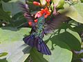
Zumbador verde
(Anthracothorax viridis) -
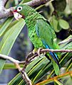
Cotorra puertorriqueña
(Amazona vittata)
Critically Endangered -
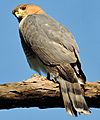
Falcón de sierra
(Accipiter striatus venator)
Endangered -
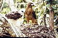
Guaragüao de bosque (Buteo platypterus brunnescens)
Endangered -
Murciélago pescador
(Noctilio leporinus) -
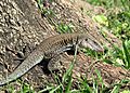
Lagarto verde
(Anolis cuvieri) -
Coquí común
(Eleutherodactylus coqui) -
Sapo común
(Bufo marinus) -
Siguana
(Ameiva exsul) -
Boa de Puerto Rico (Chilabothrus inornatus)
-
Mangosta pequeña asiática (Herpestes javanicus)
-
Dajao
(Agonostomus monticola) -
Macrobrachium
(Macrobrachium) -
Gata
(Atya lanipes)

_in_Hong_Kong.jpg)


_en_Puerto_Rico.jpg)


,_jpg_format.jpg)


_in_Puerto_Rico.jpg)
.jpg)
See also
 In Spanish: Bosque estatal de Toro Negro para niños
