Chama River (Venezuela) facts for kids
Quick facts for kids Chama |
|
|---|---|

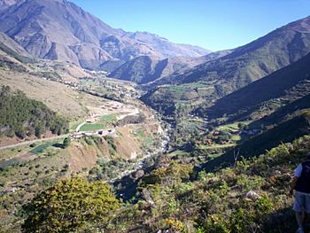
The upper section of the Chama river near the town of Cacute
|
|
| Country | Venezuela |
| State | Mérida |
| Physical characteristics | |
| Main source | Alto de Mifafí Apartaderos 2,500 m (8,200 ft) |
| River mouth | Lake Maracaibo |
| Length | 180 km (110 mi) |
| Basin features | |
| Tributaries |
|
The Chama River is one of the most important rivers in the state of Mérida in Venezuela. It starts high up in the Andes mountains and flows all the way to Lake Maracaibo. It's a long river, about 180 kilometers (112 miles) long.
Contents
About the Chama River
The Chama River begins its journey in the Mifafí highlands. These highlands are part of the Andes mountain range. The river's source is near a town called Apartaderos. Here, the river is very high up, about 2,500 meters (8,200 feet) above sea level.
Its Mountain Journey
When the Chama River first starts, it flows very fast. It's like a steep mountain stream. As it moves down the mountains, it passes by many towns. Unfortunately, water from these towns can make the river dirty.
The river then flows past the city of Mérida. The city sits on a high flat area, and the river runs at its base. Near a town called Ejido, another river, the Albarregas River, joins the Chama. This adds more water and also more pollution from Mérida city.
How the River Cleans Itself
Even though the river gets dirty, it has a special way of cleaning itself. After Ejido, the Chama River flows downhill very steeply. Its path is full of rocks. This rocky, fast-moving journey helps the water get lots of oxygen. This oxygen helps to naturally clean the river from many of its organic pollutants.
Further along, near the town of Las Gonzalez, the Chama River is still not perfectly clean, but it's often used for fun activities. People who enjoy white water rafting sometimes use this part of the river for exciting adventures.
The Chama Canyon
Near the town of Estanques, the river enters a long, narrow canyon. This canyon is about 12 kilometers (7.5 miles) long. It's a very steep and narrow part of the river's path.
The canyon is mostly tropical, which means it has lush green plants and a different feel from the high Andes mountains. This creates a beautiful natural scene.
Reaching the Lake
After leaving the canyon, the Chama River flows past El Vigía. This is the second-largest city in the state of Mérida. In its final short section, the Chama River crosses into the state of Zulia. Finally, it reaches its destination: Lake Maracaibo.
See also
 In Spanish: Río Chama para niños
 | Emma Amos |
 | Edward Mitchell Bannister |
 | Larry D. Alexander |
 | Ernie Barnes |

