Chamblissburg, Virginia facts for kids
Quick facts for kids
Chamblissburg, Virginia
|
|
|---|---|

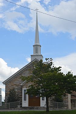
Parrish Chapel United Methodist Church
|
|
| Country | United States |
| State | Virginia |
| County | Bedford |
| Elevation | 1,080 ft (330 m) |
| Time zone | UTC-5 (Eastern (EST)) |
| • Summer (DST) | UTC-4 (EDT) |
| ZIP Codes | |
| Area code(s) | 540 and 826 |
Chamblissburg is a small, quiet community in the southwestern part of Bedford County, Virginia. It's not a city or town with its own local government, but rather a group of homes and businesses in a specific area. You can find it along State Route 24, just east of Stewartsville. Chamblissburg is also considered part of the larger Lynchburg area.
Contents
Education in Chamblissburg
Students living in Chamblissburg attend schools run by Bedford County Public Schools. Depending on where they live, younger students go to either Goodview Elementary School or Stewartsville Elementary School. After elementary school, students attend Staunton River Middle School, and then Staunton River High School.
For those interested in college, the closest higher education places are in Bedford and Roanoke.
Community Services and Safety
Keeping the Community Safe
The Bedford County Sheriff's Office helps keep the community safe. They are in charge of law enforcement in Chamblissburg.
Fire and Medical Help
The Stewartsville-Chamblissburg Volunteer Fire Department provides fire protection. They have two fire stations, and one of them is right in Chamblissburg. If someone needs emergency medical help, the Chamblissburg Volunteer Rescue Squad is there to assist. They also operate from a station within the community.
Getting Around Chamblissburg
Air Travel
If you need to fly somewhere, the Roanoke-Blacksburg Regional Airport is the closest airport that offers commercial flights.
Roads and Highways
The main road that goes through Chamblissburg is ![]() Virginia State Route 24, also known as Stewartsville Road.
Virginia State Route 24, also known as Stewartsville Road.
Train Service
For passenger train travel, the nearest station is in Roanoke.
 | Chris Smalls |
 | Fred Hampton |
 | Ralph Abernathy |


