
Charles William Wilson facts for kids
Quick facts for kids
Charles William Wilson
|
|
|---|---|
 |
|
| Born | March 14, 1836 Liverpool |
| Died | October 25, 1905 (aged 69) Tunbridge Wells |
Lieutenant-General Sir Charles William Wilson (born March 14, 1836 – died October 25, 1905) was a British Army officer. He was also a geographer, which means he studied and mapped the Earth's features, and an archaeologist, someone who studies human history by digging up old sites and artifacts. He was known for his important work mapping different parts of the world.
Contents
Early Life and First Jobs
Charles William Wilson was born in Liverpool, England, on March 14, 1836. He went to school at Liverpool Collegiate School and Cheltenham College. After that, he studied at the Royal Military Academy, Woolwich. In 1855, he became an officer in the Royal Engineers, a special part of the army that deals with engineering and mapping.
His first big job was in 1858. He worked as a secretary for the British Boundary Commission. This group's job was to map the border between the United States and Canada, specifically the 49th parallel north line, from the Rocky Mountains all the way to the Pacific Ocean. He spent four years exploring North America. He wrote about his adventures in a diary, which was later published in a book called "Mapping the Frontier."
Exploring Ancient Lands: Palestine

In 1864, Wilson started an important project called the Ordnance Survey of Jerusalem. This survey was paid for by a very rich woman named Angela Burdett-Coutts, 1st Baroness Burdett-Coutts. She wanted to find new and better sources of drinking water for the people living in Jerusalem.
While searching for water, Wilson created the most accurate map of Jerusalem ever made at that time. He also found and named a famous old structure called Wilson's Arch. Even though he couldn't find a new water source, his mapping work was incredibly valuable. Experts later said that Wilson was the first to carefully study the ancient stone walls of the Temple Mount, which is a very important historical site. His maps became the foundation for all future research about Jerusalem.

In 1867, Wilson played a key role in the PEF Survey of Palestine with the Palestine Exploration Fund. He also led one of the first major archaeological digs at the Temple Mount in Jerusalem. The next year, in 1868, he joined the Ordnance Survey of Sinai, another mapping project. In 1872, he became a member of the Society of British Archaeology.
He also helped lead the Palestine Pilgrims' Text Society. This group published old writings and translations about journeys to the Holy Land. From 1901 until he passed away in 1905, he was the chairman of the Palestine Exploration Fund.
Work in Scotland and Other Roles
After his time in the Middle East, Wilson returned to Britain. In 1867, he was assigned to the Ordnance Survey of Scotland, where he continued his mapping work. He also helped with a commission that looked at town boundaries.
In 1874, he became a Fellow of the Royal Society, which is a very respected group of scientists. He then became the director of the map-making department at the British War Office. He also worked as an assistant for the British Intelligence Department. In 1876, he received an important award called the Order of the Bath. After this, he led the Ordnance Survey in Ireland.
Travels in Turkey
From 1879 to 1882, Wilson served as a consul-general in Anatolia, which is a region in Turkey. This job meant he represented Britain there. He traveled a lot throughout Turkey during this time.
In the summer of 1882, he joined an expedition led by Garnet Wolseley. This mission was to help stop a rebellion led by Colonel 'Urabi. During this period, Wilson also helped edit a large set of books called "Picturesque Palestine, Sinai, and Egypt."
The Khartoum Expedition
From 1884 to 1885, Wilson took part in the Nile Expedition, also known as the Khartoum Relief Expedition. This was a rescue mission led by Garnet Wolseley, 1st Viscount Wolseley. Wilson was part of the smaller group that went ahead to try and rescue Major-General Charles George Gordon in Khartoum.
After their leader, Sir Herbert Stewart, was badly hurt, Wilson took command of about 1,400 men. A small part of Wilson's group, just 28 men, reached Khartoum on two boats on January 28, 1885. Sadly, they arrived two days too late. Khartoum had already been taken by another group on January 26. Many people were killed, including Major-General Gordon.
Wilson later faced some criticism for the timing of their arrival. However, other sources and historians have said that the blame should be shared, including with the main commander, Garnet Wolseley. Some also pointed to the British Prime Minister, William Ewart Gladstone, for not sending help sooner.
Leading the Ordnance Survey in Ireland
After the Khartoum expedition, Wilson was appointed director of the Ordnance Survey in Ireland. He then became the overall director-general of the survey from 1886 to 1894.
Later Life and Legacy
From 1895 until he retired in 1898, Wilson was the director-general of military education. This meant he was in charge of training for the army.
In 1895, he also edited a book called "A Traveler's Handbook in Asia Minor, Transcaucasia, Iran, etc." This book was like an encyclopedia, giving lots of information about the people and places in areas like Turkey, Kurdistan, Syria, and Iran.
Charles William Wilson passed away on October 25, 1905, in Tunbridge Wells. A book written about him later said that he "probably did more than any other man to increase the knowledge of the geography and archeology of Asia Minor, Palestine and the adjacent countries." This shows how important his work was in mapping and understanding these ancient regions.
Images for kids
-

Charles William Wilson; Ordnance Survey of Jerusalem. 1865
-
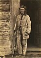
Charles Wilson, sometime between 1858 and 1861
