Charlestown Township, Ohio facts for kids
Quick facts for kids
Charlestown Township
|
|
|---|---|

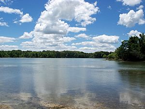
The Michael J Kirwan Reservoir in West Branch State Park
|
|
| Country | United States |
| State | Ohio |
| County | Portage |
| Area | |
| • Total | 23.1 sq mi (59.9 km2) |
| • Land | 20.3 sq mi (52.7 km2) |
| • Water | 2.8 sq mi (7.3 km2) |
| Elevation | 1,099 ft (335 m) |
| Population
(2020)
|
|
| • Total | 1,735 |
| • Density | 75.9/sq mi (29.3/km2) |
| Time zone | UTC-5 (Eastern (EST)) |
| • Summer (DST) | UTC-4 (EDT) |
| ZIP code |
44266
|
| Area code(s) | 330, 234 |
| FIPS code | 39-13610 |
| GNIS feature ID | 1086824 |
Charlestown Township is a special kind of local government area called a civil township. It is one of eighteen townships located in Portage County, Ohio, in the United States. In 2020, about 1,735 people called Charlestown Township home.
Contents
Where is Charlestown Township?
Charlestown Township is right in the middle of Portage County. It shares its borders with several other townships:
- To the north, it borders Freedom Township.
- The northeast corner touches Windham Township.
- To the east, you'll find Paris Township.
- The southeast corner is next to Palmyra Township.
- To the south, it borders Edinburg Township.
- The southwest corner is next to Rootstown Township.
- To the west, it borders Ravenna Township.
- The northwest corner touches Shalersville Township.
You won't find any big cities or towns inside Charlestown Township itself.
How Big is Charlestown?
Charlestown Township covers an area of about 23.1 square miles (which is about 59.9 square kilometers). However, a large part of this area is used for important state and federal purposes.
Special Places in Charlestown
A big section of the northern part of the township is home to Camp James A. Garfield. This is a training base for the Ohio National Guard. It was first created in 1941.
In the southern part of the township, you'll find West Branch State Park. This park includes the Michael J. Kirwan reservoir, a large lake that opened in 1966. These areas are great for outdoor activities!
A Look at History
Charlestown Township was officially started in 1814. It's unique because it's the only Charlestown Township in the entire state of Ohio. For many years, people living there could send and receive mail from a local post office. This post office was opened in 1820 and served the community until 1904.
See also
 In Spanish: Municipio de Charlestown (Ohio) para niños

