Cheetham Close facts for kids

Site of Cheetham Close
|
|
| Location | Lancashire |
|---|---|
| Coordinates | 53°38′20″N 2°25′52″W / 53.638839°N 2.431014°W |
| Type | Stone circle and ring cairn |
| History | |
| Periods | Bronze Age |
| Designated | 30 November 1925 |
| Reference no. | 1009121 |
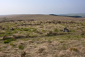
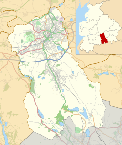
Cheetham Close is an ancient site in Lancashire, England. It is very close to the border with Greater Manchester. This site features large stones, known as megaliths. It is also a protected ancient monument. This means it is an important historical place that must be preserved.
The site was in good condition until the 1870s. At that time, a farmer damaged the stone circle. An old article from 1829 said Cheetham Close was once a special place for druids. Druids were ancient Celtic priests. The article also mentioned a Roman road nearby.
The stone circle at Cheetham Close was about 18.5 metres (61 ft) across. Six stones were clearly part of the circle. Other smaller stones were scattered around. Many of the stones have been broken over time.
Contents
Exploring Cheetham Close: Past Discoveries
Archaeologists have studied Cheetham Close for many years. Their surveys help us understand its history. These studies show how the site has changed over time.
Early Surveys of the Stone Circle
In 1850, a person named Dryden surveyed the area. He found a circle made of six stones. Later, in 1871, Greenhalgh found a seventh stone. He also noted that the site had been damaged.
In 1894, French discovered a second ancient site nearby. This was a "ring bank" type of cairn. A cairn is a mound of stones. In 1954, a saddle quern was found. A quern is a tool used for grinding grain. The site became a protected monument in 1958.
Recent Archaeological Finds
In 1959, three barbed and tanged arrowheads were found. These were discovered at a third location near Cheetham Close. Arrowheads tell us about hunting in ancient times.
A big survey happened in 1983. The Bury Archaeological Group and M. Fletcher worked on it. They found the stone circle was badly damaged. Only two of the seven large stones were still in their original spots. Experts think the circle first had ten equally spaced stones.
What We Learn from the Finds
The ring cairn is located south of the stone circle. M. Fletcher believes Cheetham Close dates back to the Early Bronze Age. This was between 2100 and 1500 BC. The quern and arrowheads give us clues about the people who lived there. They were likely a farming community. They also hunted to get food.
Images for kids
 | Selma Burke |
 | Pauline Powell Burns |
 | Frederick J. Brown |
 | Robert Blackburn |


