Cherhill, Alberta facts for kids
Quick facts for kids
Cherhill
|
|
|---|---|

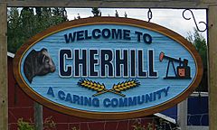
An entrance sign of Cherhill
|
|
| Country | Canada |
| Province | Alberta |
| Census division | No. 13 |
| Municipal district | Lac Ste. Anne County |
| First post office | 1911 |
| Government | |
| • Type | Unincorporated |
| Population
(2008)
|
|
| • Total | 60 |
| Time zone | UTC−7 (MST) |
| • Summer (DST) | UTC−6 (MDT) |
Cherhill is a small community called a hamlet in Alberta, Canada. It is part of Lac Ste. Anne County. You can find it along Highway 43. It's about 35 kilometers (22 miles) east of Mayerthorpe. Cherhill is also about 82 kilometers (51 miles) northwest of Edmonton.
Where is Cherhill Located?
Cherhill is in a part of Alberta called Census Division No. 13. A census division is like a region used for counting people. It helps organize areas for official records.
How Cherhill Got Its Name
The name Cherhill has an interesting story. The first part, "Cher," comes from the last part of A. P. Stetcher's name. He was the postmaster when the first post office opened in 1911. The word "hill" was simply added to it.
How Many People Live in Cherhill?
In 2008, Lac Ste. Anne County did a count of the people living in Cherhill. At that time, the population of Cherhill was 60 people.
 | George Robert Carruthers |
 | Patricia Bath |
 | Jan Ernst Matzeliger |
 | Alexander Miles |


