Chesilhurst, New Jersey facts for kids
Quick facts for kids
Chesilhurst, New Jersey
|
||
|---|---|---|
|
Borough
|
||
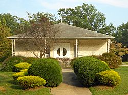
Grant A.M.E. Church
|
||
|
||
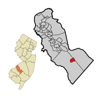
Location of Chesilhurst in Camden County highlighted in red (right). Inset map: Location of Camden County in New Jersey highlighted in orange (left).
|
||
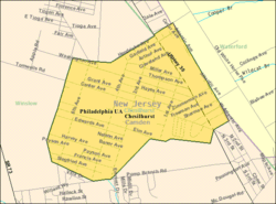
Census Bureau map of Chesilhurst, New Jersey
|
||
| Country | ||
| State | ||
| County | Camden | |
| Incorporated | November 26, 1887 | |
| Government | ||
| • Type | Borough | |
| • Body | Borough Council | |
| Area | ||
| • Total | 1.72 sq mi (4.45 km2) | |
| • Land | 1.72 sq mi (4.44 km2) | |
| • Water | 0.00 sq mi (0.00 km2) 0.12% | |
| Area rank | 430th of 565 in state 20th of 37 in county |
|
| Elevation | 151 ft (46 m) | |
| Population
(2020)
|
||
| • Total | 1,536 | |
| • Estimate
(2023)
|
1,546 | |
| • Rank | 510th of 565 in state 33rd of 37 in county |
|
| • Density | 895.4/sq mi (345.7/km2) | |
| • Density rank | 395th of 565 in state 33rd of 37 in county |
|
| Time zone | UTC−05:00 (Eastern (EST)) | |
| • Summer (DST) | UTC−04:00 (Eastern (EDT)) | |
| ZIP Code |
08089
|
|
| Area code(s) | 856 | |
| FIPS code | 3400712550 | |
| GNIS feature ID | 0885183 | |
Chesilhurst is a small town, called a borough, located in Camden County, New Jersey. In 2020, about 1,536 people lived here. Chesilhurst became an official borough on November 26, 1887. This happened after people voted for it on October 18, 1887. It was formed from parts of Waterford Township and Winslow Township.
Contents
About Chesilhurst, New Jersey
Chesilhurst is a borough in the state of New Jersey. It is part of Camden County. The town was officially created in 1887.
Where is Chesilhurst Located?
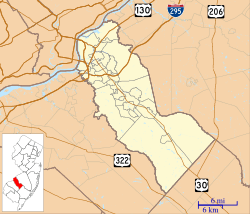
Chesilhurst is in the southern part of New Jersey. It covers an area of about 1.72 square miles (4.45 square kilometers). Most of this area is land. The borough shares its borders with two other townships: Waterford Township and Winslow Township.
How Many People Live Here?
| Historical population | |||
|---|---|---|---|
| Census | Pop. | %± | |
| 1900 | 283 | — | |
| 1910 | 246 | −13.1% | |
| 1920 | 287 | 16.7% | |
| 1930 | 298 | 3.8% | |
| 1940 | 308 | 3.4% | |
| 1950 | 314 | 1.9% | |
| 1960 | 384 | 22.3% | |
| 1970 | 801 | 108.6% | |
| 1980 | 1,590 | 98.5% | |
| 1990 | 1,526 | −4.0% | |
| 2000 | 1,520 | −0.4% | |
| 2010 | 1,634 | 7.5% | |
| 2020 | 1,536 | −6.0% | |
| 2023 (est.) | 1,546 | −5.4% | |
| Population sources: 1900–2000 1900–1920 1900–1910 1910–1930 1940–2000 2000 2010 2020 |
|||
In 2020, the population of Chesilhurst was 1,536 people. This was a small decrease from the 1,634 people counted in 2010. The population has changed over the years. For example, in 1900, only 283 people lived here.
The people living in Chesilhurst come from different backgrounds. In 2020, about 41% of the residents were White, and about 38% were Black or African American. Around 14% of the population identified as Hispanic or Latino.
Education in Chesilhurst
Chesilhurst used to have its own school district, the Chesilhurst Borough School District. Students in kindergarten through sixth grade attended Shirley B. Foster Elementary School. However, after the 2008–2009 school year, the district stopped running its own schools.
Now, all students from Chesilhurst attend schools in the Winslow Township School District. This is part of a special agreement between the two districts. Even though there are no schools in Chesilhurst, a school board of seven members still helps make decisions for the students. These board members are chosen by voters every three years.
Getting Around Chesilhurst
Chesilhurst has many roads for cars and other vehicles. As of 2010, there were almost 20 miles of roads in the borough. Most of these roads are taken care of by the town itself.
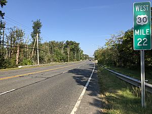
The main road that goes through Chesilhurst is U.S. Route 30. Another road, County Route 536, runs along the southern edge of the town for a short distance. If you need to travel further, the Atlantic City Expressway is close by in neighboring Winslow Township.
For public transportation, NJ Transit offers a local bus service. The Route 554 bus connects Chesilhurst to the Lindenwold train station and also goes to Atlantic City.
See also
 In Spanish: Chesilhurst para niños
 | William L. Dawson |
 | W. E. B. Du Bois |
 | Harry Belafonte |


