Cheyenne Wells, Colorado facts for kids
Quick facts for kids
Cheyenne Wells, Colorado
|
|
|---|---|

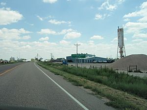
Cheyenne Wells (2011)
|
|

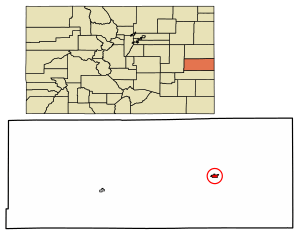
Location within Cheyenne County and Colorado
|
|
| Country | United States |
| State | Colorado |
| County | Cheyenne |
| Founded | 1870s |
| Incorporated | May 14, 1890 |
| Area | |
| • Total | 1.070 sq mi (2.770 km2) |
| • Land | 1.070 sq mi (2.770 km2) |
| • Water | 0 sq mi (0.000 km2) |
| Elevation | 4,292 ft (1,308 m) |
| Population
(2020)
|
|
| • Total | 758 |
| • Density | 708.7/sq mi (273.65/km2) |
| Time zone | UTC−7 (MST) |
| • Summer (DST) | UTC−6 (MDT) |
| ZIP Code |
80810
|
| Area code | 719 |
| FIPS code | 08-14175 |
| GNIS ID | 195261 |
Cheyenne Wells is a small town in Colorado, United States. It is also the main town, or "county seat," of Cheyenne County. In 2020, about 758 people lived there.
Contents
A Look at Cheyenne Wells History
The town of Cheyenne Wells got its name because the Cheyenne people used to have water wells near where the town was first built. This happened way back in the 1870s. The town was officially made a municipality on May 14, 1890.
Where is Cheyenne Wells?
Cheyenne Wells is located in Colorado, a state in the western United States. It covers a total area of about 2.77 square kilometers (which is roughly 1.07 square miles). All of this area is land.
There's a cool fact about Cheyenne Wells: a small area about 10 miles southwest of the town is "antipodal." This means it's exactly on the opposite side of the Earth from Île Saint-Paul, an island in the southern Indian Ocean. Imagine digging straight through the Earth from Cheyenne Wells – you'd come out near that island!
Cheyenne Wells Weather
Cheyenne Wells has a climate with warm summers and cold winters. The hottest temperature ever recorded was 109°F (43°C) in July, and the coldest was -31°F (-35°C) in February. The town gets about 16 inches (41 cm) of rain each year and around 19.5 inches (50 cm) of snow.
Who Lives in Cheyenne Wells?
The number of people living in Cheyenne Wells has changed over the years. Here's how the population has grown and shrunk:
- 1910: 270 people
- 1920: 508 people
- 1930: 595 people
- 1940: 695 people
- 1950: 1154 people
- 1960: 1020 people
- 1970: 982 people
- 1980: 950 people
- 1990: 1128 people
- 2000: 1010 people
- 2010: 846 people
- 2020: 758 people
In 2000, there were 1,010 people living in Cheyenne Wells. Most of the people were White (about 91%). About 10% of the population identified as Hispanic or Latino. The average age of people in the town was 38 years old.
What is the Economy Like?
A company called Tumbleweed Midstream owns the Ladder Creek Helium Plant near Cheyenne Wells. This plant is very important because it's one of only about 14 helium plants in the entire world! Helium is a gas used for many things, like balloons and in science.
Getting Around Cheyenne Wells
Transportation Options
Railroads
The Union Pacific Railroad has train tracks that go right through Cheyenne Wells. This is part of a large railway system that helps move goods across the country.
Major Highways
![]() U.S. Highway 40 is a main road that passes through Cheyenne Wells. It generally runs alongside the railway tracks. This highway is an important route for cars and trucks traveling through the area.
U.S. Highway 40 is a main road that passes through Cheyenne Wells. It generally runs alongside the railway tracks. This highway is an important route for cars and trucks traveling through the area.
Famous People from Cheyenne Wells
- Nellie M. Payne (1900-1990) was an important agricultural chemist and entomologist (someone who studies insects). She was born in Cheyenne Wells.
See also
 In Spanish: Cheyenne Wells (Colorado) para niños
 | William Lucy |
 | Charles Hayes |
 | Cleveland Robinson |

