Chiguayante facts for kids
Quick facts for kids
Chiguayante
|
|||||
|---|---|---|---|---|---|

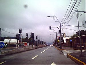
Manuel Rodriguez Avenue.
|
|||||
|
|||||
| Country | Chile | ||||
| Region | Biobío | ||||
| Province | Concepción | ||||
| Established | 1996 | ||||
| Government | |||||
| • Type | Municipality | ||||
| Area | |||||
| • Total | 71.5 km2 (27.6 sq mi) | ||||
| Elevation | 249 m (817 ft) | ||||
| Population
(2012 Census)
|
|||||
| • Total | 84,718 | ||||
| • Density | 1,184.9/km2 (3,068.8/sq mi) | ||||
| • Urban | 81,238 | ||||
| • Rural | 64 | ||||
| Demonym(s) | Chiguayantino | ||||
| Sex | |||||
| • Men | 38,524 | ||||
| • Women | 42,778 | ||||
| Time zone | UTC−4 (CLT) | ||||
| • Summer (DST) | UTC−3 (CLST) | ||||
| Area code(s) | 56 + 41 | ||||
| Website | Official website: http://www.chiguayante.cl | ||||
Chiguayante is a vibrant city and commune in Chile. It is located in the Biobío Region, specifically in Concepción Province. Chiguayante is also part of a larger urban area known as Greater Concepción. The city was officially established in 1996.
About Chiguayante
How Many People Live in Chiguayante?
Every few years, countries count their people. This is called a census. According to the 2002 census, Chiguayante had 81,302 residents.
Most people, about 99.9%, lived in the city's urban areas. Only a small number, about 0.1%, lived in rural areas. The city has grown a lot! Between 1992 and 2002, the population increased by 44.2%. By 2010, it was estimated that about 119,265 people lived here.
Who Runs the City?
Chiguayante is a "commune," which is like a local district. It is managed by a municipal council. The council works with an alcalde, who is like the city's mayor.
The mayor is chosen by the people in an election every four years. The current mayor is Tomás Solís Nava. He is a member of the Socialist Party.
See also
 In Spanish: Chiguayante para niños
 | Aurelia Browder |
 | Nannie Helen Burroughs |
 | Michelle Alexander |


