Chinquapin, California facts for kids
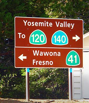
Chinquapin is a former small settlement in Mariposa County, California. It is located inside Yosemite National Park. Chinquapin is about 8.5 miles (13.7 km) north-northwest of Wawona. It is also right next to the community of Yosemite West. Chinquapin is important because it's the halfway point between Yosemite Valley and Wawona, both popular spots in the park.
History of Chinquapin
How Chinquapin Started
Chinquapin began as a meeting point for roads. The Old Glacier Point Road was built here in 1882. Before that, it was just a trail for horses going to Glacier Point. On an old map from 1896, it was called "Chinquapin Station." The current Glacier Point Road, which starts nearby, was built much later in 1940.
Where the Name Comes From
Chinquapin got its name from Chinquapin Creek. This creek is just northwest of the settlement. Today, Chinquapin Creek is called Indian Creek. The creek, and then the settlement, were named after a plant. This plant is called the Sierra Chinquapin. It's a type of brush that grows in the area. It has spiny seeds, which makes it easy to spot!
Skiing Adventures at Chinquapin
Chinquapin was once the second place for skiing in Yosemite. This ski area opened after the Wawona Tunnel was built. The tunnel made it possible for people to visit during winter. Before Chinquapin, people skied in Yosemite Valley. They skied on a rocky hill near the horse stables. Later, the main ski area moved from Chinquapin. It moved to Badger Pass, which is also on the Old Glacier Point Road. Today, the main ski area is in Simpson Meadow, below Badger Pass.
The Old Gas Station and Lodge
Chinquapin used to have a gas station. It stayed open until the 1990s. Before it was a gas station, it was a small ski lodge. Some people called it a "lunch room." This lodge opened in 1933. The gas station site was later cleaned up. This was because of pollution from the gas. The park's new company, Delaware North, cleaned it up in 1993.
Historic Buildings and Landscape
The Chinquapin area has many old buildings and features. These are part of its "cultural landscape." This means they show how the area was designed and used long ago. The most important time for these buildings was from 1933 to 1938. During these years, many structures were built.
Some of these important features include:
- The intersection of Glacier Point Road and Wawona Road.
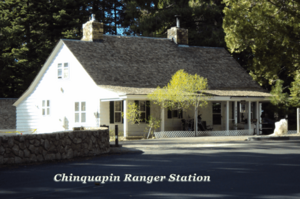
- The Ranger Station, built in 1934.
- A Garage/Storage building, also from 1934.
- A Comfort Station (restroom), built in 1933.
- A Redwood Water Tank, built in 1936.
These old structures help tell the story of Chinquapin. They show how the park developed over time.
Chinquapin and Badger Pass Today
A Stopping Point
Today, Chinquapin is mostly a stopping point for visitors. It has new restroom facilities. These restrooms use advanced systems for wastewater. This helps test new ways to manage water in the park. This effort also connects to the new Yosemite Institute campus. This campus is part of NatureBridge. NatureBridge is a non-profit group that works with Yosemite National Park. They help visitors learn about and care for the park.
Winter Travel and Tire Chains
During the winter, Chinquapin is very important. It's a place where drivers must put on tire chains. This happens before they drive up to the Badger Pass Ski Area. Park rangers and crews are often there. They help visitors put the chains on their vehicles correctly. If the weather is too bad, or if Badger Pass parking is full, rangers will close the road. They close the gates at Chinquapin. This stops cars from going up Glacier Point Road.
Hiking Trails Near Chinquapin
Deer Camp Trailhead
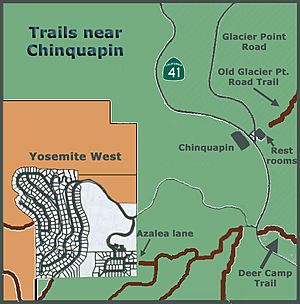
The Deer Camp trailhead is just south of Chinquapin. It's also near Glacier Point Road. As you hike on this trail, you'll go above Highway 41. The trail crosses over Rail Creek and Strawberry Creek. It then leads to Deer Camp on Empire Meadow. The end of this trail is in the town of Wawona.
Old Glacier Point Trail
The Old Glacier Point Trail also starts at Chinquapin. It's one of the few trails right in this area. You can find it about 100 feet behind the restroom building. It's also behind the old water tank. As its name suggests, this trail used to be a road. It heads northeast. On some trail maps, this trail is marked as #7.
This trail was once a bridle path. It was later rebuilt as a wagon road. This allowed vehicles to reach Glacier Point. Today, parts of the Old Glacier Point Road are considered historic. They are important because they show how transportation developed in the park.
 | Sharif Bey |
 | Hale Woodruff |
 | Richmond Barthé |
 | Purvis Young |


