Chisos Mountains facts for kids
Quick facts for kids Chisos Mountains |
|
|---|---|

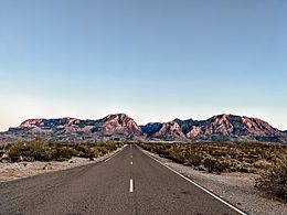
The Chisos Mountains as photographed facing southeast
|
|
| Highest point | |
| Peak | Emory Peak |
| Elevation | 7,825 ft (2,385 m) |
| Geography | |
| Country | |
| State | |
| Range coordinates | 29°16′N 103°18′W / 29.267°N 103.300°W |
The Chisos Mountains, also called the Chisos, are a mountain range in the Big Bend area of Texas, United States. This mountain system covers about 40 square miles (104 square km). It is special because it is the only mountain range in the U.S. that is completely inside a national park, Big Bend National Park. The Chisos Mountains are also the southernmost mountain range in the mainland United States.
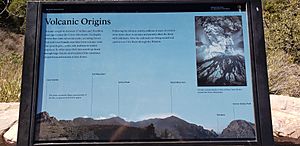
These mountains were formed by volcanoes a very long time ago. This happened between 35 and 44 million years ago.
The tallest point in the Chisos Mountains is Emory Peak. It stands at 7,825 feet (2,385 meters) above sea level.
Contents
Where are the Chisos Mountains?
The Chisos Mountains are found inside Big Bend National Park. The mountains stretch for about 20 miles. They go from Punta de la Sierra in the southwest to Panther Junction in the northeast.
The park has many trails for visitors to explore. You can also find campsites in the backcountry. Some trails and campsites are closed from February to May. This helps protect the peregrine falcons that live there.
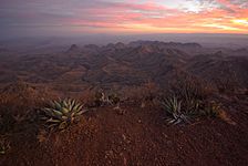
The mountain area has some forests. These forests are growing back after being cut down and overgrazed. This happened before the area became a National Park in the 1930s. The mountains are surrounded by the Chihuahuan Desert.
What Does "Chisos" Mean?
The name "Chisos" might come from a Spanish word. One idea is that it comes from hechizos, which means "enchantment." Another idea is that it comes from a Native American word. This word, chisos, might mean "ghost" or "spirit."
Tallest Peaks
Here are some of the highest peaks in the Chisos Mountains:
- Emory Peak is 7,825 feet (2,385 m) tall.
- Lost Mine Peak is 7,535 feet (2,297 m) tall.
- Toll Mountain is 7,415 feet (2,260 m) tall.
- Casa Grande Peak is 7,325 feet (2,233 m) tall.
Climate in the Mountains
The Chisos Mountains have a unique climate. The elevation of the Chisos Basin is about 5,300 feet (1,615 m). This higher elevation makes the weather different from the surrounding desert.
| Climate data for Chisos Basin, Texas (Aug 1, 1943–Mar 31, 2013) | |||||||||||||
|---|---|---|---|---|---|---|---|---|---|---|---|---|---|
| Month | Jan | Feb | Mar | Apr | May | Jun | Jul | Aug | Sep | Oct | Nov | Dec | Year |
| Record high °F (°C) | 82 (28) |
84 (29) |
96 (36) |
96 (36) |
99 (37) |
103 (39) |
102 (39) |
99 (37) |
97 (36) |
94 (34) |
89 (32) |
87 (31) |
103 (39) |
| Mean daily maximum °F (°C) | 58.3 (14.6) |
61.8 (16.6) |
68.7 (20.4) |
76.3 (24.6) |
82.8 (28.2) |
86.8 (30.4) |
84.8 (29.3) |
83.7 (28.7) |
79.5 (26.4) |
73.8 (23.2) |
65.2 (18.4) |
59.4 (15.2) |
73.4 (23.0) |
| Daily mean °F (°C) | 47.6 (8.7) |
50.4 (10.2) |
56.4 (13.6) |
63.9 (17.7) |
70.7 (21.5) |
75.1 (23.9) |
74.2 (23.4) |
73.2 (22.9) |
69.0 (20.6) |
62.9 (17.2) |
54.2 (12.3) |
48.7 (9.3) |
62.2 (16.8) |
| Mean daily minimum °F (°C) | 36.9 (2.7) |
39.1 (3.9) |
44.1 (6.7) |
51.5 (10.8) |
58.5 (14.7) |
63.3 (17.4) |
63.7 (17.6) |
62.7 (17.1) |
58.6 (14.8) |
51.9 (11.1) |
43.2 (6.2) |
37.9 (3.3) |
51.0 (10.6) |
| Record low °F (°C) | −3 (−19) |
1 (−17) |
12 (−11) |
25 (−4) |
37 (3) |
45 (7) |
53 (12) |
52 (11) |
34 (1) |
19 (−7) |
13 (−11) |
4 (−16) |
−3 (−19) |
| Average precipitation inches (mm) | 0.68 (17) |
0.58 (15) |
0.41 (10) |
0.62 (16) |
1.59 (40) |
2.21 (56) |
3.39 (86) |
3.12 (79) |
2.48 (63) |
1.51 (38) |
0.57 (14) |
0.51 (13) |
17.67 (449) |
| Average snowfall inches (cm) | 0.8 (2.0) |
0.5 (1.3) |
0.1 (0.25) |
0.0 (0.0) |
0.0 (0.0) |
0.0 (0.0) |
0.0 (0.0) |
0.0 (0.0) |
0.0 (0.0) |
0.0 (0.0) |
0.4 (1.0) |
0.3 (0.76) |
2.1 (5.3) |
| Average precipitation days (≥ 0.001 in) | 3.59 | 2.99 | 2.22 | 2.74 | 4.51 | 7.30 | 9.60 | 8.88 | 7.64 | 4.77 | 2.90 | 2.83 | 60.19 |
| Source: Western Regional Climate Center, Desert Research Institute | |||||||||||||
Amazing Wildlife
The Chisos Mountains are home to many different animals.
Birds of the Chisos Mountains
About 81 different kinds of birds live in the Chisos Mountains. They are found in six main plant areas. Each plant area has different types of birds:
- Arroyo-Mesquite-Acacia area: 31 bird species.
- Lechuguilla-Creosotebush-Cactus area: 13 bird species.
- Sotol-Grass area: 32 bird species.
- Deciduous Woodland area: 42 bird species.
- Pinyon-Juniper-Oak area: 32 bird species.
- Cypress-Pine-Oak area: 24 bird species.
Ants of the Chisos Mountains
The Chisos Mountains also have many types of ants. There are 81 known species of ants here. These ants belong to 29 different main groups, called genera.
Images for kids
See also
 In Spanish: Montañas Chisos para niños
 | Leon Lynch |
 | Milton P. Webster |
 | Ferdinand Smith |


