
Ciego de Ávila Province facts for kids
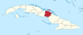
Ciego de Ávila is one of the provinces in Cuba. It used to be part of the larger Camagüey Province. The capital city of this province is also called Ciego de Ávila. This city is located right on Cuba's main highway, known as the Carretera Central. The second biggest city in the province is Morón, which is located further north.
Off the northern coast of Ciego de Ávila, you'll find a group of small islands called cayos. These islands are becoming popular places for tourists to visit. The most famous ones are Cayo Coco and Cayo Guillermo. On the southern coast, the land is covered with mangrove forests.
Between the city of Morón and the northern coast, there are several lakes. One of them is called La Laguna de Leche, which means "The Lake of Milk." It got this name because its water looks white due to a lot of lime deposits underwater. It's also the largest natural lake in Cuba!
The central part of Ciego de Ávila is used for raising cattle. In other areas of the province, farmers grow sugar, pineapples, and citrus fruit.
The province of Ciego de Ávila was officially separated from Camagüey Province in 1975 by the government of Fidel Castro.
Cities and Towns
The province of Ciego de Ávila is divided into several smaller areas called municipalities. Each municipality has its own main town. Here are the municipalities in Ciego de Ávila:
- Baraguá (its main town is Gaspar)
- Bolivia
- Chambas
- Ciego de Ávila
- Ciro Redondo
- Florencia
- Majagua
- Morón
- Primero de Enero
- Venezuela
Images for kids
-
Map showing Ciego de Ávila Province in Cuba


See also
 In Spanish: Provincia de Ciego de Ávila para niños
