Clarington, Pennsylvania facts for kids
Quick facts for kids
Clarington, Pennsylvania
|
|
|---|---|
|
Unincorporated community
|
|

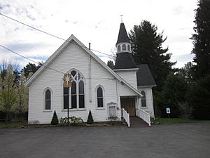
Clarington Methodist Church
|
|
| Country | United States |
| State | Pennsylvania |
| County | Forest |
| Township | Barnett |
| Elevation | 1,201 ft (366 m) |
| Time zone | UTC-5 (Eastern (EST)) |
| • Summer (DST) | UTC-4 (EDT) |
| ZIP code |
15828
|
| Area code(s) | 814 |
| GNIS feature ID | 1209504 |
Clarington is a small place in Pennsylvania, United States. It's not a city or a town with its own local government. Instead, it's called an unincorporated community. This means it's part of a larger area called a township, specifically Barnett Township. Clarington is located in Forest County.
Where is Clarington Located?
Clarington is found in the beautiful state of Pennsylvania. It sits right on the north side of the Clarion River. You can find it near the Pennsylvania Route 899 bridge. This community is about 12 miles (19 kilometers) north of a larger town called Brookville.
What is an Unincorporated Community?
An unincorporated community like Clarington is a group of homes or buildings that don't have their own separate local government. They are usually part of a larger area, like a township or county. People living there still get services, but these are managed by the bigger local government.
Post Office and ZIP Code
Clarington used to have its own post office. This is where people would send and receive mail. The post office in Clarington closed on February 20, 2004. Even though the post office is closed, Clarington still has its own special ZIP code, which is 15828. A ZIP code helps the postal service sort mail and deliver it to the right place.
 | Stephanie Wilson |
 | Charles Bolden |
 | Ronald McNair |
 | Frederick D. Gregory |


