Clate facts for kids
Quick facts for kids Clate
|
|
|---|---|
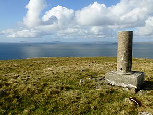
 Vanessa Trig On Ward of Clett |
|
| OS grid reference | HU540615 |
| Civil parish |
|
| Council area | |
| Lieutenancy area | |
| Country | Scotland |
| Sovereign state | United Kingdom |
| Post town | SHETLAND |
| Postcode district | ZE2 |
| Dialling code | 01806 |
| Police | Northern |
| Fire | Highlands and Islands |
| Ambulance | Scottish |
| EU Parliament | Scotland |
| UK Parliament |
|
| Scottish Parliament |
|
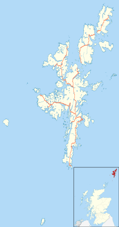
Clate, also known as Clett, is a small settlement and a local area (called a ward) located in the southwestern part of Whalsay island. Whalsay is one of the many Shetland Islands in Scotland. Clate is part of the larger parish of Nesting.
Contents
Exploring Clate's Location
Clate is found just south of Symbister, which is the biggest village on Whalsay. You can find Clate along the main road that leads out of Symbister, right after you pass Sandwick.
Coastal Features Near Clate
The coastline around Clate has some interesting natural spots. These include Haa Ness and Dimni Geo, which are special names for parts of the coast. Just off the shore, you can also see the Holm of Sandwick, which is a small island.
Caves and Hills Around Clate
If you head southeast from Clate, you'll discover several caves. There's also a path that goes southeast, leading up to an old quarry. From there, the path continues uphill, passing by the southwestern side of a hill called the Ward of Clett.
Clate's Wartime History
During World War II, the British military set up a special radar camp in Clate. A radar camp uses equipment to detect planes or ships from a distance. Even in 1986, some of the buildings and structures, like sheds, that the military built were still being used.
A Plane Crash During World War II
Sadly, a type of airplane called a Catalina bomber crashed near Clate early in World War II. Catalina bombers were large planes often used for searching the seas and for rescue missions.
 | William M. Jackson |
 | Juan E. Gilbert |
 | Neil deGrasse Tyson |


