
Clay, Pennsylvania facts for kids
Quick facts for kids
Clay, Pennsylvania
|
|
|---|---|

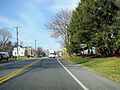
Keystone Marker along westbound US 322 entering Clay
|
|

Clay, Pennsylvania
Location in Pennsylvania

Clay, Pennsylvania
Location in the United States
|
|
| Country | United States |
| State | Pennsylvania |
| County | Lancaster |
| Township | Clay |
| Area | |
| • Total | 2.25 sq mi (5.82 km2) |
| • Land | 2.24 sq mi (5.79 km2) |
| • Water | 0.01 sq mi (0.03 km2) |
| Elevation | 359 ft (109 m) |
| Population
(2020)
|
|
| • Total | 1,869 |
| • Density | 835.87/sq mi (322.73/km2) |
| Time zone | UTC-5 (Eastern (EST)) |
| • Summer (DST) | UTC-4 (EDT) |
| ZIP code |
17522 (Ephrata)
|
| Area code(s) | 717 |
| FIPS code | 42-13952 |
| GNIS feature ID | 1171942 |
Clay is a small community in Lancaster County, Pennsylvania, United States. It is also known as a census-designated place (CDP). A CDP is a special area that the U.S. Census Bureau defines for gathering population data. It is not an officially incorporated town or city.
Clay is located in Clay Township. You can find it along U.S. Route 322, between the towns of Brickerville and Ephrata. In 2020, about 1,869 people lived in Clay.
Contents
Where is Clay Located?
Clay is in the northern part of Lancaster County. It sits in the southern area of Clay Township. The community of Hopeland is to its west and northwest.
U.S. Route 322 is an important road here. It goes about 12 miles (19 km) northwest to Quentin. It also goes about 5 miles (8 km) southeast to Ephrata. Clay is located about 14 miles (23 km) north of Lancaster, which is the main city of the county.
What is the Area Like?
The U.S. Census Bureau measures the size of places like Clay. The total area of Clay is about 2.25 square miles (5.8 square kilometers). Most of this area is land. Only a tiny part, about 0.01 square miles (0.03 square kilometers), is water.
A stream called Middle Creek flows through the western side of Clay. This creek also forms the border between Clay Township and Elizabeth Township. Middle Creek flows southeast into Cocalico Creek. Cocalico Creek then joins the Conestoga River, which is part of the larger Susquehanna River system.
How Many People Live in Clay?
| Historical population | |||
|---|---|---|---|
| Census | Pop. | %± | |
| 2020 | 1,869 | — | |
| U.S. Decennial Census | |||
The population of Clay has been counted by the U.S. Census over the years. In 2020, the population was 1,869 people. This information helps us understand how the community has grown.
Images for kids
-
A sign marking the entrance to Clay along US 322.
See also
 In Spanish: Clay (Pensilvania) para niños
