Clifton, Tennessee facts for kids
Quick facts for kids
Clifton, Tennessee
|
|
|---|---|

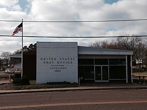
Post office in Clifton
|
|
| Motto(s):
"Working for you!"
|
|

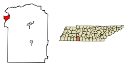
Location of Clifton in Wayne County, Tennessee.
|
|
| Country | United States |
| State | Tennessee |
| County | Wayne |
| Area | |
| • Total | 6.13 sq mi (15.88 km2) |
| • Land | 5.56 sq mi (14.41 km2) |
| • Water | 0.57 sq mi (1.48 km2) |
| Elevation | 404 ft (123 m) |
| Population
(2020)
|
|
| • Total | 2,651 |
| • Density | 476.63/sq mi (184.02/km2) |
| Time zone | UTC-6 (Central (CST)) |
| • Summer (DST) | UTC-5 (CDT) |
| ZIP code |
38425
|
| Area code(s) | 931 |
| FIPS code | 47-15480 |
| GNIS feature ID | 1305972 |
| Website | http://www.cityofclifton.com/ |
Clifton is a small city in Wayne County, Tennessee. It's located right on the Tennessee River, close to the border with Alabama. Long ago, in the 1800s, Clifton was an important river port. Today, you can still see historic areas that remind us of its past. In 2020, about 2,651 people lived here.
Contents
Discover Clifton: A City on the River
Clifton is a city with an interesting past and a friendly community. It's known for its connection to the Tennessee River. This river helped the city grow a long time ago.
Famous People from Clifton
Clifton is proud to be the hometown of T. S. Stribling. He was a very popular American writer in the 1920s and 1930s. In 1933, he won the Pulitzer Prize for the Novel. This is a very important award for writers! His winning book was called The Store.
You can visit the T. S. Stribling Museum in Clifton. It's located in a historic area called the Water Street Historic District. This area is special because it shows what the city was like when it was a busy river port.
Another notable person from Clifton is Robert Selph Henry. He was important in the railroad industry and also a historian.
Community Facilities in Clifton
Clifton is home to a large facility called the South Central Correctional Facility. This facility is for adults.
Clifton's Location and Size
Clifton is located in the state of Tennessee. Its exact spot on a map is 35°22′58″N 87°59′31″W / 35.38278°N 87.99194°W.
The city covers a total area of about 6.13 square miles (15.88 square kilometers). Most of this area is land, with a small part being water from the river.
Clifton's Population Over Time
| Historical population | |||
|---|---|---|---|
| Census | Pop. | %± | |
| 1880 | 300 | — | |
| 1890 | 529 | 76.3% | |
| 1900 | 639 | 20.8% | |
| 1910 | 711 | 11.3% | |
| 1950 | 818 | — | |
| 1960 | 708 | −13.4% | |
| 1970 | 737 | 4.1% | |
| 1980 | 773 | 4.9% | |
| 1990 | 620 | −19.8% | |
| 2000 | 2,699 | 335.3% | |
| 2010 | 2,694 | −0.2% | |
| 2020 | 2,651 | −1.6% | |
| Sources: | |||
Who Lives in Clifton?
In 2020, there were 2,651 people living in Clifton. People from many different backgrounds make up the community.
| Group | Number | Percentage |
|---|---|---|
| White (not Hispanic) | 1,747 | 65.9% |
| Black or African American (not Hispanic) | 771 | 29.08% |
| Native American | 1 | 0.04% |
| Other/Mixed backgrounds | 37 | 1.4% |
| Hispanic or Latino | 95 | 3.58% |
This table shows the different groups of people living in Clifton based on the 2020 census.
Learning and Education in Clifton
Clifton has several places for learning.
- Frank Hughes School is a local school.
- Columbia State Community College offers higher education opportunities.
- Frank Hughes College used to be here but is no longer open.
Local Radio Station
Clifton has its own radio station! It's called "Sunny 106.5" (WLVS-FM). You can listen to adult contemporary music on this station.
Businesses and Transportation
Local Manufacturing
Clifton is home to a few manufacturing businesses:
- American Whirlpool
- Brown Foreman (a company that makes wooden barrel parts)
- Cross Brand Leather
Getting Around Clifton
Several highways pass through Clifton, making it easy to travel to and from the city:
 US 641 (U.S. Route 641)
 SR 128 (State Route 128)
 SR 228 (State Route 228)
For air travel, the Hassell-Carroll Field Airport is located nearby.
See also
In Spanish: Clifton (Tennessee) para niños
 | Calvin Brent |
 | Walter T. Bailey |
 | Martha Cassell Thompson |
 | Alberta Jeannette Cassell |

