Clinton River (Arnold River tributary) facts for kids
Quick facts for kids Clinton River |
|
|---|---|

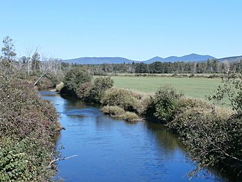
Clinton River a few hundred meters before its confluence with the Arnold River, seen from Chemin de la Rivière-Bergeron.
|
|
| Native name | Rivière Clinton |
| Country | Canada |
| Province | Quebec |
| Region | Estrie |
| MRC | Le Granit Regional County Municipality |
| Physical characteristics | |
| Main source | Moutain streams Notre-Dame-des-Bois (canton de Chesham) 597 metres (1,959 ft) 45°21′19″N 71°00′00″W / 45.35535°N 71.000088°W |
| River mouth | Arnold River Saint-Augustin-de-Woburn 395 metres (1,296 ft) 45°25′08″N 70°51′55″W / 45.41883°N 70.86528°W |
| Length | 21.8 kilometres (13.5 mi) |
| Basin features | |
| Progression | Rivière Arnold, Lake Mégantic, Chaudière River, St. Lawrence River |
| River system | St. Lawrence River |
| Basin size | 265 kilometres (164.66 mi) |
| Tributaries |
|
The Clinton River (in French: rivière Clinton) is a river in Quebec, Canada. It flows north and eventually joins the Arnold River. From there, its waters travel through Lake Mégantic, the Chaudière River, and finally reach the mighty St. Lawrence River.
This river winds its way through three towns: Notre-Dame-des-Bois, Quebec, Saint-Augustin-de-Woburn, and Piopolis. These towns are part of the Le Granit Regional County Municipality in the Estrie region of Quebec.
Where Does the Clinton River Start?
The Clinton River begins its journey in the municipality of Notre-Dame-des-Bois. Its source is about 2 kilometers (1.2 miles) northeast of a mountain called Saddle Mountain. This area is very close to the border between Canada and the United States.
How Long is the River's Journey?
The Clinton River flows for about 21.8 kilometers (13.5 miles). As it travels, it passes through different areas:
- It flows east for 1.7 km (1.1 miles) in the Chesham area of Notre-Dame-des-Bois.
- Then, it turns northeast for 2.7 km (1.7 miles), passing a bridge on Route 212.
- It continues northeast for 4.2 km (2.6 miles), where another stream joins it.
- The river then flows into the Clinton area.
- It travels northeast for 4.9 km (3.0 miles), meeting another stream from the west.
- Next, it goes northeast for 1.6 km (1.0 miles) until it reaches the town of Piopolis.
- In Piopolis, it flows east and then curves north for 2.5 km (1.6 miles).
- It turns southeast for 2.8 km (1.7 miles), where a stream from the south joins it.
- Finally, it flows northeast for 1.0 km (0.6 miles), crossing a road called "Chemin de la rivière Bergeron," before it meets the Arnold River.
The Clinton River ends its journey by flowing into the Arnold River. This meeting point is in a marshy area between Piopolis and Saint-Augustin-de-Woburn.
What's in a Name?
The name rivière Clinton was officially recognized on December 5, 1968. This was done by the Commission de toponymie du Québec, which is the organization in Quebec responsible for naming places.
 | John T. Biggers |
 | Thomas Blackshear |
 | Mark Bradford |
 | Beverly Buchanan |


