Clough River facts for kids
Quick facts for kids Clough River |
|
|---|---|

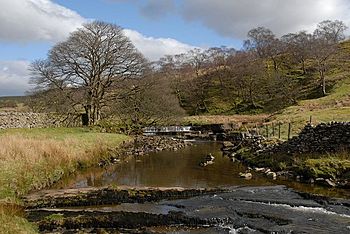
Waterfalls near Garsdale Head
|
|
|
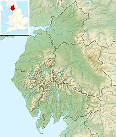
Location of the mouth within Cumbria
|
|
| Country | England |
| Region | North West England |
| County | Cumbria |
| Physical characteristics | |
| Main source | Grisedale Beck Clough Farm, Garsdale 54°19.492′N 2°20.126′W / 54.324867°N 2.335433°W |
| River mouth | Confluence with River Rawthey 54°19′28″N 2°29′57″W / 54.324418°N 2.499167°W |
| Length | 21.8 km (13.5 mi) |
The Clough River is a small river in Cumbria, England. It's like a smaller stream that flows into a bigger river called the River Rawthey. The Clough River travels about 21.8 kilometers (around 13.5 miles). It mostly flows through a beautiful valley known as Garsdale.
Contents
The River's Journey
Where the River Starts
The Clough River begins in a place called Grisedale. This is in the south-east part of Cumbria. Here, several smaller streams join together. They flow down from a hill called Grisedale Pike. These streams form what is known as Grisedale Beck.
The young Clough River then flows through a short valley. This valley is also called Grisedale. It's sometimes known as "The Dale That Died." The river even goes over a waterfall here. It officially gets the name Clough River at Clough Farm, in Garsdale Head. This is where it enters the main Garsdale valley. This valley is shaped by the river itself. It lies between Baugh Fell to the north and Rise Hill to the south.
Flowing Through Garsdale
The Clough River is mostly shallow and rocky. It has some deeper spots, or pools, where you could even swim. But be warned, the water is always very cold! A main road, the A684, follows the river for about seven miles. You'll see many bridges crossing the river in the upper part of the valley.
As the river continues, it reaches Longstone Fell. Here, the old main road goes up to a great viewpoint. From this spot, you can see the Howgill Fells. The river then flows down to Danny Bridge. This place used to have a mill in the 1600s.
Joining Other Rivers
Finally, the Clough River joins the River Rawthey. This meeting point is near a place called Dowbiggin Foot, close to Sedbergh. After that, the River Rawthey then joins the River Lune at Middleton Bridge.
The Sedgwick Trail
In 1985, a special walking path was opened. It's called the Sedgwick Trail. This trail is named after a famous geologist, Adam Sedgwick (1785-1873). A geologist is a scientist who studies rocks and the Earth.
The Sedgwick Trail follows the Clough River from Danny Bridge. As you walk along the path, you can see interesting rock features. These features help explain the Dent Fault. A fault is a crack in the Earth's crust where rocks have moved.
Location and History
The area where the Clough River flows used to be part of an old county. This was called the West Riding of Yorkshire. Even today, the river's entire length is inside the Yorkshire Dales National Park. This is a special protected area. However, the whole river is now officially in the South Lakeland district of Cumbria.
 | Stephanie Wilson |
 | Charles Bolden |
 | Ronald McNair |
 | Frederick D. Gregory |


