Cochamó facts for kids
Quick facts for kids
Cochamó
|
||||
|---|---|---|---|---|

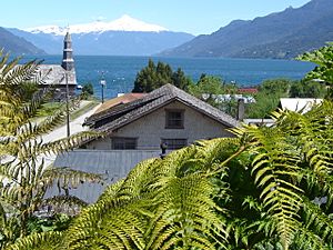
Reloncaví Estuary with Yate volcano in the background and the town of Cochamó in the foreground.
|
||||
|
||||
| Country | Chile | |||
| Region | Los Lagos | |||
| Province | Llanquihue | |||
| Founded | 1979 | |||
| Government | ||||
| • Type | Municipality | |||
| Area | ||||
| • Total | 3,910.8 km2 (1,510.0 sq mi) | |||
| Elevation | 7 m (23 ft) | |||
| Population
(2012 Census)
|
||||
| • Total | 3,908 | |||
| • Density | 0.99928/km2 (2.5881/sq mi) | |||
| • Urban | 0 | |||
| • Rural | 4,363 | |||
| Sex | ||||
| • Men | 2,506 | |||
| • Women | 1,857 | |||
| Time zone | UTC-4 (CLT) | |||
| • Summer (DST) | UTC-3 (CLST) | |||
| Area code(s) | country 56 + city 65 | |||
| Website | Municipality of Cochamó | |||
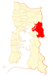
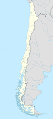
Cochamó is a cool town and a special area (called a commune) in Chile. It's found in the Llanquihue Province, which is part of the Los Lagos Region. The main town in this area is Río Puelo, named after the Puelo River.
Contents
Cochamó's Story: A Look at Its History
Cochamó became an official commune in 1979. But people lived here long before that, even in ancient times! Over time, more people settled down and built the town.
Today, a fun activity called ecotourism is growing here. Ecotourism means visiting nature in a way that protects it. Most people in Cochamó have Spanish roots. You might also find a few families with German or Italian backgrounds.
Who Lives in Cochamó?
In 2002, a count of people (called a census) showed that Cochamó covers a huge area of about 3,910 square kilometers. About 4,363 people lived there at that time. Most people lived in the countryside, making Cochamó a very rural place. The number of people living here stayed almost the same between 1992 and 2002.
Places to Explore Near Cochamó
If you visit Cochamó, there are some amazing places nearby to explore:
- Cochamó Valley
- Vicente Pérez Rosales National Park
See also
 In Spanish: Cochamó para niños
 | Isaac Myers |
 | D. Hamilton Jackson |
 | A. Philip Randolph |


