Cochato River facts for kids

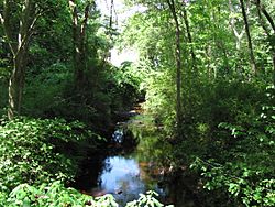
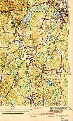
The Cochato River is a small river that starts in Avon, Massachusetts. It flows north for several miles until it joins with the Monatiquot River in Braintree. This river is part of a larger water system called the Weymouth Fore River watershed. Eventually, its water flows into Boston Harbor. The Cochato River also acts as a natural border between the towns of Braintree and Randolph.
Contents
About the Cochato River
The Cochato River is an important waterway in Massachusetts. It connects several towns and plays a role in the local environment. Rivers like the Cochato are vital for wildlife and can also be used by people for different purposes.
Where Does the Cochato River Flow?
The journey of the Cochato River begins in the town of Avon. From there, it travels north, passing through different areas. Its path eventually leads it to meet the Monatiquot River. This meeting point is located in Braintree. The water then continues its journey as part of the larger Weymouth Fore River system, finally reaching the sea at Boston Harbor.
A River's Past: Water Supply
In the past, the Cochato River was a very important source of drinking water. It helped fill the Richardi Reservoir. This reservoir supplied water to almost 90,000 people. These people lived in the towns of Holbrook, Randolph, and Braintree. However, the river stopped being used for drinking water in the 1980s. This change happened because the water became very polluted.
Cleaning Up the River
For many years, from 1912 to 1983, a company called Baird & McGuire operated near the river in Holbrook. This company made various chemical products, like pesticides and disinfectants. Unfortunately, the company did not store or dispose of its waste properly. Because of these poor practices, harmful industrial waste was released into the soil, the river, nearby wetlands, and a gravel pit.
What is a Superfund Site?
Because of the serious pollution, the area was declared a "superfund" site in 1983. A Superfund site is a place in the United States that has been polluted with hazardous waste. The Environmental Protection Agency (EPA) is in charge of cleaning up these sites. The goal is to protect human health and the environment.
The Cleanup Efforts
The Environmental Protection Agency (EPA) took action to clean up the Cochato River. They worked hard to remove the pollution. For example, they dug out and treated more than 4,000 cubic yards (about 3,060 cubic meters) of dirty mud from the riverbed. The main cleanup work was finished in 1997. Since then, the river has been carefully watched to make sure it stays clean and healthy. This monitoring helps protect the river for everyone.
 | Misty Copeland |
 | Raven Wilkinson |
 | Debra Austin |
 | Aesha Ash |


