
Monatiquot River facts for kids
Quick facts for kids Monatiquot River |
|
|---|---|
| Country | United States |
| Physical characteristics | |
| Main source | Braintree, Massachusetts 30 feet (9 m) |
| River mouth | Weymouth Fore River sea level 42°13′25″N 70°58′03″W / 42.2236°N 70.9676°W |
| Length | 4.9 miles (7.9 km) |
| Basin features | |
| Basin size | 28.7 square miles (74 km2) |
The Monatiquot River is a short river, about 4.9 miles (7.9 kilometers) long, located in Braintree, Massachusetts. It starts where two smaller rivers, the Farm River and Cochato River, meet in the Braintree Municipal Golf Course. From there, it winds its way northeast through swampy areas and eventually flows into the Weymouth Fore River, which is an estuary (where fresh and salt water mix). The name "Monatiquot" likely means "at the deep tidal place" or "lookout place." The area of land that drains into this river is about 28.7 square miles (74.3 square kilometers).
Contents
A River Through Time
The Monatiquot River has been very important to the town of Braintree for a long time. In the past, when Braintree was a colony, the river was known for its river herring, a type of fish. The strong flow of the river was also very useful for early industries.
Early Industries and Mills
Many years ago, the river's power helped run grist mills, which were used to grind grain into flour. This was a very important job for the community.
A famous American, Paul Revere, even had a nail mill on the Monatiquot River. He operated this mill until the 1860s. At that time, the mill was updated with new equipment. The company that made nails there later moved to southeastern Massachusetts. It is still in business today, using some of the same equipment that was installed back in the 1860s!
Wildlife and River Health
The Monatiquot River is home to many different kinds of animals. You can find birds, turtles, muskrats, and various types of fish living in and around the water.
Aquatic Life
One special fish that uses the Monatiquot River is the rainbow smelt. These fish come to the river to lay their eggs, a process called spawning. The smelt that spawn here provide good fishing opportunities for people in the surrounding area.
River Cleanliness
For many years, the Monatiquot River has stayed fairly clean. However, recently, there has been some pollution from sediments. This pollution comes from a concrete operation nearby. People are working to keep the river healthy for all the plants and animals that live there.
Images for kids
-
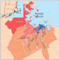
Weymouth watershed
-
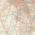
Monatiquot River and environs

_map.jpg)
