Connors River facts for kids
Quick facts for kids Connors |
|
|---|---|
|
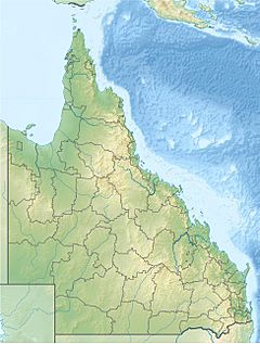
Location of Connors River mouth in Queensland
|
|
| Country | Australia |
| State | Queensland |
| Region | Central Queensland |
| Physical characteristics | |
| Main source | Chinaman Ridges, Great Dividing Range |
| River mouth | confluence with the Isaac River northwest of Middlemount 104 m (341 ft) 22°48′47″S 149°04′04″E / 22.81306°S 149.06778°E |
| Length | 301 km (187 mi) |
| Basin features | |
| Lagoons and waterholes |
Boat Hole; Main Camp Lagoon; Lotus Creek; Lake Plattaway; Knobbys Waterhole |
The Connors River is an important waterway in Central Queensland, Australia. It's a long river, stretching for about 301 kilometers (187 miles). The river is also an "anabranch," which means it's a channel that leaves the main river and then rejoins it later.
Where the River Starts and Flows
The Connors River begins where two smaller creeks meet. This meeting point is called a confluence. The two creeks are Collaroy Creek and Whelan Creek. They meet east of a place called Lotus Creek.
The very start of the river is in the Chinaman Ridges. These ridges are part of the huge Great Dividing Range. The river generally flows west first. Then it turns south near Mount Bridget. It crosses the Marlborough-Sarina Road.
As it continues, the river often splits into many smaller channels. These channels are called "braided channels." The river then flows south by southwest. It crosses an area called Bar Plains. Here, it forms even more channels. Finally, it flows into the Isaac River in several spots. This is northwest of Middlemount.
Along its path, the Connors River passes through many natural pools and waterholes. Some of these include the Boat Hole, Main Camp Lagoon, Lotus Creek, Lake Plattaway, and Knobbys Waterhole. The river drops about 59 meters (194 feet) from where it starts to where it ends.
Plans for a Dam
In February 2015, the Queensland Government approved a big plan. They decided to build a dam on the Connors River. This dam will be near Mount Bridgett. That's about 110 kilometers (68 miles) east of Moranbah.
When the dam is finished, it will create a large reservoir. A reservoir is like a huge artificial lake. This reservoir is expected to hold a lot of water. It will store about 373,662 megaliters of water. That's enough water to fill over 149,000 Olympic-sized swimming pools! This water will be used for coal mines and for communities in the area.
How the River Got Its Name
The Connors River was named in 1856. It was named by a famous explorer and surveyor named Augustus Charles Gregory. He named the river to honor Daniel Conner. Daniel Conner was a "pastoralist." A pastoralist is someone who raises livestock, like sheep or cattle, on a large farm or ranch. Augustus Gregory was also the Surveyor General of Queensland. This was an important job where he was in charge of mapping the land.
 | John T. Biggers |
 | Thomas Blackshear |
 | Mark Bradford |
 | Beverly Buchanan |


