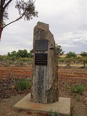
Coomooroo, South Australia facts for kids
Quick facts for kids CoomoorooSouth Australia |
|||||||||||||||
|---|---|---|---|---|---|---|---|---|---|---|---|---|---|---|---|
| Postcode(s) | 5431 | ||||||||||||||
| LGA(s) |
|
||||||||||||||
| State electorate(s) | Stuart | ||||||||||||||
| Federal Division(s) | Grey | ||||||||||||||
|
|||||||||||||||
| Footnotes | Adjoining localities | ||||||||||||||
Coomooroo is a small rural area located in the Mid North region of South Australia. It's about a three-hour drive north of Adelaide. In 2021, only 13 people lived there, so Coomooroo is now considered a ghost town.
Most of Coomooroo is part of the District Council of Orroroo Carrieton. A smaller part on its western side belongs to the District Council of Mount Remarkable.
Contents
Discovering Coomooroo's Past
Coomooroo is on the traditional lands of the Ngadjuri people. These Indigenous Australians lived here for thousands of years. Their history is very important to the area.
How Coomooroo Got Its Name
The name Coomooroo comes from the Hundred of Coomooroo. A "Hundred" is an old way of dividing land. In 1875, Governor Anthony Musgrave named it. The name means "small food seeds" in an Aboriginal language. People used to call the area "Poverty Corner" informally. But the District Council of Mount Remarkable asked for the official name Coomooroo. In 1882, land in this area was put up for sale.
Farming and Challenges
The way land was settled in the Upper North of South Australia is interesting. In the 1860s, new laws changed how land was used. Large areas that were once for grazing animals became farmland. This was a big change for Australia.
Coomooroo is just north of Goyder's Line. This line shows where there's usually enough rain for crops. North of the line, there isn't enough rain for farming. So, the land is mostly for grazing animals. Even with efforts to develop the region, bad weather often caused problems. As early as 1876, newspapers reported on the difficulties settlers faced in Coomooroo.
Community Life and Memories
The Coomooroo School opened in 1881. It taught local children until it closed in 1917. Residents wanted a post office, but one was set up in nearby Morchard instead. Over the years, Coomooroo had different community groups. These included an Agricultural Board, a dog coursing club, a cricket club, and a tennis club.
One resident, Robert Wilfred Robertson, died fighting in World War 1. He is remembered at the Australian War Memorial. In 1976, a book called "Reflections" was made. It told the story of the Morchard District and the Hundred of Coomooroo. This book was part of the 100-year celebrations for Morchard and Coomooroo. Later, in 2001, a plaque was put up in Morchard. It marked 125 years since European settlement in both Morchard and Coomooroo.
Historic Places to See
Pekina Run Ruins
The historic Pekina Run Ruins are at the south-eastern end of Coomooroo. These ruins are very important. They are listed on the South Australian Heritage Register. The Pekina Run was a large homestead from the 1840s. It was later abandoned and fell into ruin. Today, you can still see the remains of this early settlement.
 | Roy Wilkins |
 | John Lewis |
 | Linda Carol Brown |


