Cordova Pass (Colorado) facts for kids
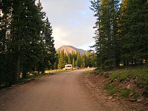
Cordova Pass is a high mountain pass in southern Colorado. It sits at about 11,260 feet (3,430 meters) above sea level. The pass is located on the side of the West Spanish Peak. It is also east of the Sangre de Cristo Mountains.
Cordova Pass is just outside the Spanish Peaks Wilderness. This is a special area set aside to protect nature. The pass is part of the San Isabel National Forest. You can reach Cordova Pass by driving on the Apishapa Road. This road is part of the Scenic Highway of Legends. This highway is known for its beautiful views.
Because of heavy snow, the pass is usually closed. It is not open from mid-November to late May. Most of the time, regular cars can drive over the pass when it is open.
History of Cordova Pass
Before 1934, this pass was called Apishapa Pass. The road over Cordova Pass was finished in 1934. It was built by groups like the Works Progress Administration (WPA) and the Civilian Conservation Corps (CCC). These were government programs that helped people find work during tough economic times.
The road was officially opened on September 9, 1934. It was named after Jose De Jesus Cordova (1856-1929). He was a well-known person in Colorado. For over 40 years, he ran a ranch near Aguilar. He also helped get money for the road project in 1928. Jose Cordova served his community. He was elected three times as a Las Animas County Commissioner.
What to Do at Cordova Pass
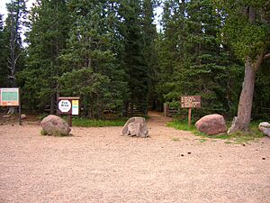
At the top of Cordova Pass, there are a few things to make your visit comfortable. You can find restrooms and several picnic tables. There are also a couple of simple campsites if you want to stay overnight. Keep in mind that this is a "Fee Area," so there might be a small charge to use some facilities.
The pass is a great starting point for hiking. The trailhead for several trails is on the north side of the road. These include the West Spanish Peak Trail and the Vista Point Trail. The Vista Point Trail is even designed for people with disabilities. You can also find the start of the Wahatoya Trail and the Apishapa Trail here.
About a quarter-mile (400 meters) down the main trail, you will find a special plaque. This plaque shows that the Spanish Peaks are a designated National Natural Landmark. This means they are recognized for their unique natural features.


