
Coto, Isabela, Puerto Rico facts for kids
Quick facts for kids
Coto
|
|
|---|---|
|
Barrio
|
|

Ruins of Ermita San Antonio de Padua
|
|

Location of Coto within the municipality of Isabela shown in red
|
|

Coto, Isabela, Puerto Rico
Location in Caribbean
|
|
| Commonwealth | |
| Municipality | |
| Area | |
| • Total | 4.99 sq mi (12.9 km2) |
| • Land | 4.38 sq mi (11.3 km2) |
| • Water | 0.61 sq mi (1.6 km2) |
| Elevation | 295 ft (90 m) |
| Population
(2010)
|
|
| • Total | 3,575 |
| • Density | 816.2/sq mi (315.1/km2) |
| Source: 2010 Census | |
| Time zone | UTC−4 (AST) |
Coto is a small area, called a barrio, located in the town of Isabela, Puerto Rico. In 2010, about 3,575 people lived there.
History of Coto
Coto has an interesting history. After the Spanish–American War, Spain gave Puerto Rico to the United States. This happened because of a special agreement called the Treaty of Paris of 1898. Puerto Rico then became a territory of the United States.
In 1899, the United States government counted everyone living in Puerto Rico. They found that 1,349 people lived in Coto barrio at that time. Over the years, the number of people living in Coto has changed, as you can see in the table below.
| Historical population | |||
|---|---|---|---|
| Census | Pop. | %± | |
| 1900 | 1,349 | — | |
| 1910 | 1,567 | 16.2% | |
| 1920 | 1,646 | 5.0% | |
| 1930 | 1,787 | 8.6% | |
| 1940 | 1,892 | 5.9% | |
| 1950 | 2,125 | 12.3% | |
| 1980 | 2,864 | — | |
| 1990 | 3,262 | 13.9% | |
| 2000 | 3,799 | 16.5% | |
| 2010 | 3,575 | −5.9% | |
| U.S. Decennial Census 1899 (shown as 1900) 1910-1930 1930-1950 1980-2000 2010 |
|||
Gallery
-
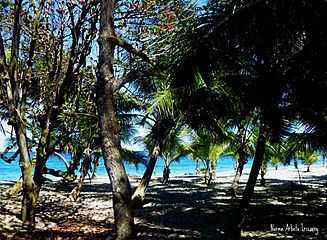
Beach in Coto, Isabela

See also
 In Spanish: Coto (Isabela) para niños
- List of communities in Puerto Rico

All content from Kiddle encyclopedia articles (including the article images and facts) can be freely used under Attribution-ShareAlike license, unless stated otherwise. Cite this article:
Coto, Isabela, Puerto Rico Facts for Kids. Kiddle Encyclopedia.