Cova Lima Municipality facts for kids
Quick facts for kids
Cova Lima
|
|||
|---|---|---|---|
|
|||
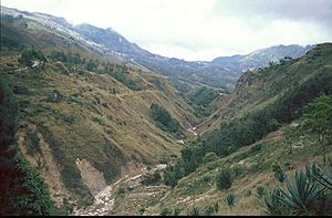
Mountain area in Cova Lima
|
|||
|
|||
|
|||
|
OpenStreetMap
|
|||
| Country | |||
| Capital | Suai | ||
| Administrative posts |
|
||
| Area | |||
| • Total | 1,198.6 km2 (462.8 sq mi) | ||
| Area rank | 7th | ||
| Population
(2015 census)
|
|||
| • Total | 65,301 | ||
| • Rank | 9th | ||
| • Density | 54.4811/km2 (141.105/sq mi) | ||
| • Density rank | 9th | ||
| Households (2015 census) | |||
| • Total | 12,564 | ||
| • Rank | 8th | ||
| Time zone | UTC+09:00 (TLT) | ||
| ISO 3166 code | TL-CO | ||
| HDI (2017) | 0.618 medium · 3rd |
||
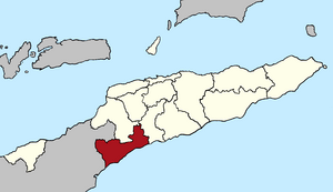
Cova Lima is a municipality, which is like a region or district, in the country of East Timor. It's located in the southwest part of the country. In 2010, about 59,455 people lived there. It covers an area of 1,230 square kilometers. The main town and capital of Cova Lima is Suai. Suai is about 136 kilometers away from Dili, which is the capital city of East Timor.
What Does "Cova Lima" Mean?
The name "Cova Lima" has a couple of interesting explanations. One idea is that it comes from two words: koba and lima.
Koba is a special basket used in traditional ceremonies. Lima is the Tetum word for 'five'. So, "Cova Lima" might mean 'five baskets'. This could refer to five mythical daughters of a traditional Timorese ruler. It might also mean five old kingdoms: Fatumea, Dakolo, Lookeu, Sisi, and Maudemi.
Another explanation suggests the name comes from kaua lima, which means 'five crows' in the Tetum language.
Where is Cova Lima?
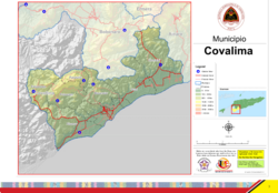
Cova Lima is located in the southwest of East Timor. It has a long coastline along the Timor Sea to the south. To the north, it shares borders with the Bobonaro region. On its eastern side, you'll find the Ainaro region. To the west, Cova Lima borders the Indonesian province of East Nusa Tenggara.
Parts of Cova Lima
Cova Lima is divided into smaller areas called administrative posts. These are:
- Fatululic
- Fatumean
- Fohorem
- Zumalai
- Maucatar
- Suai
- Tilomar
See also
 In Spanish: Distrito de Cova-Lima para niños
 | Valerie Thomas |
 | Frederick McKinley Jones |
 | George Edward Alcorn Jr. |
 | Thomas Mensah |


