Cowles Mountain facts for kids
Quick facts for kids Cowles Mountain |
|
|---|---|

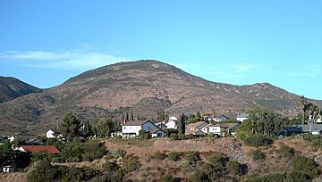
Cowles Mountain as seen from San Diego. A remnant of the "S" can be seen near the summit.
|
|
| Highest point | |
| Elevation | 1,593 ft (486 m) NAVD 88 |
| Prominence | 991 ft (302 m) |
| Geography | |
| Topo map | USGS La Mesa |
| Climbing | |
| Easiest route | Trail |
Cowles Mountain is a cool mountain located in the San Carlos neighborhood of San Diego, California. Its top, which is 1,593-foot (486 m) high, is the highest point in the entire city of San Diego!
This special mountain is protected inside Mission Trails Regional Park. It's a favorite spot for people who love to hike and explore.
Contents
Discovering Cowles Mountain's Past
Cowles Mountain is named after a person named George A. Cowles. He was a rancher and an early business person in the San Diego area during the 1870s and 1880s.
The Famous "S" on the Mountain
For many years, Cowles Mountain was known as "S" Mountain. In 1931, about 500 students from San Diego State College painted a huge letter "S" on the side of the mountain. This "S" was 400-foot-tall (120 m)!
During World War II, in April 1942, the local military asked for the "S" to be covered up. This was done for national security reasons. After the war ended, the tradition of repainting the "S" started again.
In the 1970s, the yearly repainting stopped. This was to help protect the environment and animal habitats on the mountain. There was a short time in the late 1980s when it was repainted again. But the "S" has not been repainted for almost 30 years now.
Exploring Mission Trails Regional Park
The whole mountain, with its marked trails, is a protected area. It's part of Mission Trails Regional Park, which first opened in 1972. This park helps keep the natural beauty of the mountain safe.
Hiking Trails to the Summit
The main trail to the top of Cowles Mountain is very popular. Hundreds of people hike it every day! From the summit, you can see amazing 360-degree views of San Diego County.
The hike to the top is about 1.5 miles (2.4 km) long. You will climb about 950 feet (290 m) in elevation. This main trail starts at the corner of Golfcrest Drive and Navajo Road. There is also another trail that is not used as much. It starts near Boulder Lake Avenue and Barker Way and meets the main trail closer to the top.
On March 25, 2013, the trails on Cowles Mountain were closed for repairs. They reopened in May 2013 after some improvements. These changes helped with water drainage and made the rock steps better for hikers.
Understanding Cowles Mountain's Geology
Cowles Mountain is made of very old rocks. These rocks formed during the Jurassic and early Cretaceous periods. They are a type of igneous rock that is very strong and does not wear away easily.
On the south and east sides of the mountain, there are small flat areas. These are parts of an old land surface called the Poway Terrace. This area was once near sea level but is now about 1,200 feet (370 m) high.
On the west side, there is a clear former sea cliff. Below it, there was once a flat area carved by waves. This area is now mostly covered by homes and buildings, and it is about 600 feet (180 m) high.
 | Selma Burke |
 | Pauline Powell Burns |
 | Frederick J. Brown |
 | Robert Blackburn |


