Coyolate River facts for kids
Quick facts for kids Coyolatea River |
|
|---|---|
|
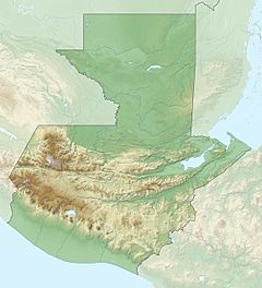
Location of mouth
|
|
| Native name | Río Coyolate (Spanish) |
| Country | Guatemala |
| Physical characteristics | |
| Main source | Guatemala (Chimaltenango, Suchitepéquez) 2,400 m (7,900 ft) 14°27′17″N 91°05′44″W / 14.454712°N 91.095457°W |
| River mouth | Pacific Ocean 0 m (0 ft) 13°57′14″N 91°18′41″W / 13.953976°N 91.311493°W |
| Length | 155 km (96 mi) |
The Río Coyolate is an important river located in the southwest part of Guatemala. It starts high up in the mountains and flows all the way to the Pacific Ocean. Rivers like the Coyolate are very important for the environment and for people living nearby.
Contents
Where the River Starts and Ends
The Source: High in the Mountains
The Río Coyolate begins its journey in the Sierra Madre mountain range. This mountain range is found in the department of Chimaltenango in Guatemala. The river's source is quite high, at about 2,400 m (7,900 ft) above sea level.
The Mouth: Meeting the Pacific Ocean
From the mountains, the river flows southwards. It travels through the lower lands of Suchitepéquez and Escuintla. Finally, the Río Coyolate reaches the Pacific Ocean, where its waters join the sea.
The River's Journey and Basin
How Long is the River?
The Río Coyolate is about 155 km (96 mi) long. This makes it a significant waterway in the region.
What is a River Basin?
A river basin is the entire area of land where water drains into a particular river. For the Río Coyolate, its basin covers a large territory of about 1,648 square kilometres (636 sq mi). This means all the rain that falls in this area will eventually flow into the Coyolate river.
See also
- In Spanish: Río Coyolate para niños


