Crane Prairie Reservoir facts for kids
Quick facts for kids Crane Prairie Reservoir |
|
|---|---|

Crane Prairie Reservoir
|
|
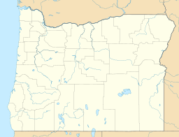
| Location | Deschutes County, Oregon |
| Coordinates | 43°46′50″N 121°48′02″W / 43.780638°N 121.800613°W |
| Type | Reservoir |
| Primary inflows | Deschutes River |
| Primary outflows | Deschutes River |
| Catchment area | 185 sq mi (480 km2) |
| Basin countries | United States |
| Designation | Wildlife Management Area within the Deschutes National Forest |
| Built | 1922, 1940 |
| Surface area | 3,420 acres (1,380 ha) |
| Average depth | 15.5 ft (4.7 m) |
| Max. depth | 20 ft (6.1 m) |
| Water volume | 55,300 acre⋅ft (68,200,000 m3) |
| Shore length1 | 22 mi (35 km) |
| Surface elevation | 4,452 ft (1,357 m) |
| 1 Shore length is not a well-defined measure. | |
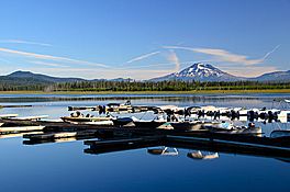
Crane Prairie Reservoir is a large, man-made lake in Oregon, United States. It's located about 42 miles (68 km) southwest of the city of Bend. This reservoir is famous for its amazing fishing and beautiful natural surroundings.
Contents
What is Crane Prairie Reservoir?
Crane Prairie Reservoir gets its name from two things. First, many cranes live in the area, enjoying the rich habitat. Second, before the lake was created, this spot was a wide, open grassland called a prairie, right along the upper Deschutes River.
Building the Reservoir
The reservoir was created by building a dam on the Deschutes River. The first dam was finished in 1922. Later, in 1940, the dam was rebuilt by a group called the Bureau of Reclamation. This made the reservoir even bigger and better for storing water.
A Home for Fish and Wildlife
Crane Prairie Reservoir is one of Oregon's best places for fishing, especially for rainbow trout. These fish grow very large here! The biggest trout ever caught in the lake weighed an incredible 19-pound (8.6 kg).
The Deschutes River's Journey
The Deschutes River is very important to the reservoir. It starts at Little Lava Lake and flows south for about 8.4 miles (13.5 km) until it reaches Crane Prairie Reservoir. After passing through the reservoir and over the dam, the river continues its journey south to another lake called Wickiup Reservoir.
Size and Features
This reservoir is quite large, covering an area of about 3,420 acres (1,380 ha). It's not very deep, with an average depth of 15.5 feet (4.7 m) and a maximum depth of 20 feet (6.1 m). The shoreline stretches for about 22 miles (35 km), offering many spots for fishing and exploring. The reservoir sits at an elevation of 4,452 feet (1,357 m) above sea level. It is also part of a special area called a Wildlife Management Area within the Deschutes National Forest, which helps protect the animals and plants that live there.
 | Sharif Bey |
 | Hale Woodruff |
 | Richmond Barthé |
 | Purvis Young |


