Crawfish Lake (Grant County, Oregon) facts for kids
Quick facts for kids Crawfish Lake |
|
|---|---|

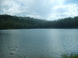
Crawfish Lake on July 3, 2009
|
|
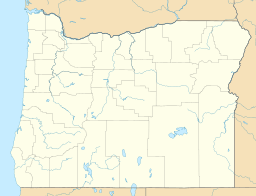
| Location | Elkhorn Mountain Range, Grant County, Oregon, U.S. |
| Coordinates | 44°56′10″N 118°15′53″W / 44.9360°N 118.2647°W |
| Type | Tarn |
| Basin countries | United States |
| Max. length | 441 yd (403 m) |
| Max. width | 255 yd (233 m) |
| Surface elevation | 6,896 ft (2,102 m) |
Crawfish Lake is a beautiful glacial lake found high up in the Elkhorn Mountain Range. This mountain range is part of the larger Blue Mountains in Northeastern Oregon.
The lake is located between two towns, North Powder and Granite. It's about 1.5 miles southwest of some other lakes called Hoffer Lakes. You can't drive to Crawfish Lake because there are no roads for cars. But don't worry, there's a popular hiking trail that leads right to it!
Contents
Exploring Crawfish Lake: The Trail
Want to visit Crawfish Lake? You can get there by following the Crawfish Lake Trail, also known as Trail #1606.
Where does the trail start?
The starting point for the Crawfish Lake Trail is called the Crawfish Lake Trailhead. You'll find it on Forest Road 73, which is also known as the Elkhorn Scenic Byway. It's just a few miles past a place called Anthony Lake.
How long is the hike?
The hike from the trailhead to Crawfish Lake is about 1.5 miles long. The trail goes downhill towards the lake. Along the way, you'll cross a stream several times. Most of these stream crossings have bridges, but a few do not, so be ready to step carefully!
What about beyond the lake?
The Crawfish Lake Trail doesn't end at the lake. It continues for another 1.5 miles past Crawfish Lake. This part of the trail leads to another trailhead called the Upper Crawfish Lake Trailhead, which is at the end of Forest Road 7300-216. The U.S. Forest Service says this trail is moderately difficult, or even more challenging in some spots.
 | Delilah Pierce |
 | Gordon Parks |
 | Augusta Savage |
 | Charles Ethan Porter |


