Culver, Kansas facts for kids
Quick facts for kids
Culver, Kansas
|
|
|---|---|

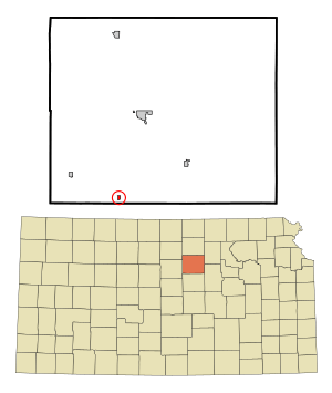
Location within Ottawa County and Kansas
|
|

|
|
| Country | United States |
| State | Kansas |
| County | Ottawa |
| Founded | 1870s |
| Platted | 1878 |
| Incorporated | 1909 |
| Named for | George Washington Culver |
| Area | |
| • Total | 0.14 sq mi (0.35 km2) |
| • Land | 0.14 sq mi (0.35 km2) |
| • Water | 0.00 sq mi (0.00 km2) |
| Elevation | 1,260 ft (380 m) |
| Population
(2020)
|
|
| • Total | 114 |
| • Density | 810/sq mi (326/km2) |
| Time zone | UTC-6 (CST) |
| • Summer (DST) | UTC-5 (CDT) |
| ZIP code |
67484
|
| Area code | 785 |
| FIPS code | 20-16700 |
| GNIS ID | 2393693 |
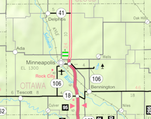
Culver is a small city in Ottawa County, Kansas, United States. In 2020, about 114 people lived there. It is located northwest of Salina, near an old railroad line.
Contents
History of Culver
Culver was first planned around 1878. The city was named after a brave man named George Washington Culver. He lived in Ottawa County, Kansas, in 1868.
George Washington Culver's Story
George Washington Culver became a scout for Colonel George Forsyth. This was during a time when there were conflicts with Native American groups. On September 17, 1868, Culver and 49 other scouts were attacked. About 1,000 warriors, led by Roman Nose, surrounded them. This battle is known as Beecher Island.
The scouts found cover on a small island in a river. They fought for three days. Many scouts were hurt, and they ran out of food. George Washington Culver was one of five scouts who died during the battle. He was buried at the battle site. Later, his remains were moved to Fort Leavenworth National Cemetery.
Before this, George Washington Culver served in the Civil War. He was a Second Lieutenant in the Second Colorado Cavalry. After the war, he worked as a watchmaker. He was also elected to a public office in Ottawa County shortly before he died. Both the city and the area around it, called a township, were named to honor him.
Culver's Post Office
A post office opened in Culver in 1873. It served the community for many years. However, it closed down in 1984.
Geography of Culver
The United States Census Bureau says that Culver covers a total area of about 0.15 square miles (0.35 square kilometers). All of this area is land.
People of Culver
| Historical population | |||
|---|---|---|---|
| Census | Pop. | %± | |
| 1910 | 326 | — | |
| 1920 | 234 | −28.2% | |
| 1930 | 206 | −12.0% | |
| 1940 | 195 | −5.3% | |
| 1950 | 153 | −21.5% | |
| 1960 | 200 | 30.7% | |
| 1970 | 148 | −26.0% | |
| 1980 | 167 | 12.8% | |
| 1990 | 162 | −3.0% | |
| 2000 | 164 | 1.2% | |
| 2010 | 121 | −26.2% | |
| 2020 | 114 | −5.8% | |
| U.S. Decennial Census | |||
Culver is part of the Salina area. This area is known as the Salina Micropolitan Statistical Area.
Population in 2020
In 2020, there were 114 people living in Culver. There were 41 households and 25 families. The population density was about 640 people per square mile. Most of the people living in Culver were white.
About 21% of the people were under 18 years old. About 30% were 65 years or older. The average age in Culver was 54 years.
Population in 2010
In 2010, Culver had 121 residents. There were 48 households and 34 families. The city's population density was about 807 people per square mile. Most residents were white, with a small number of African American, Native American, and Asian people.
About 17% of the residents were under 18. About 16% were 65 or older. The average age in the city was 47.3 years.
Education in Culver
The public schools in Culver are part of the Twin Valley USD 240 school district.
Notable People
- George Washington Carver, a famous scientist and inventor, lived near Culver for a short time.
See also
 In Spanish: Culver (Kansas) para niños
 | Stephanie Wilson |
 | Charles Bolden |
 | Ronald McNair |
 | Frederick D. Gregory |

