Curryville, Indiana facts for kids
Quick facts for kids
Curryville, Indiana
|
|
|---|---|
| Country | United States |
| State | Indiana |
| County | Adams, Wells |
| Township | Kirkland, Lancaster |
| Elevation
<
|
840 ft (260 m) |
| Time zone | UTC-5 (Eastern (EST)) |
| • Summer (DST) | UTC-4 (EDT) |
| ZIP code |
46792
|
| Area code(s) | 260 |
| GNIS feature ID | 433257 |
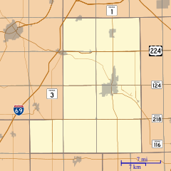
Curryville is a small, unincorporated community located in the state of Indiana, United States. It is found across two different areas: Adams County and Wells County. An unincorporated community means it's a recognized place, but it doesn't have its own local government like a city or town does.
History of Curryville
Curryville has a history that goes back to the mid-1800s.
How Curryville Started
The community of Curryville was officially planned in 1859. When a place is "platted," it means that its streets, lots, and public areas were drawn out on a map. This helps organize how the community will grow.
Curryville's Post Office
For many years, Curryville had its very own post office. This post office opened in 1879, which was a big deal for the people living there. It meant they could send and receive mail right in their own community. However, the post office eventually closed down in 1907.
 | Aurelia Browder |
 | Nannie Helen Burroughs |
 | Michelle Alexander |


