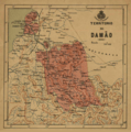
Daman district, India facts for kids
Daman district is one of the two districts in the union territory of Daman and Diu in western India. It's a small but interesting area right on the coast.
This district is surrounded by the Valsad District of Gujarat state on three sides (north, east, and south). To the west, it meets the Persian Gulf, which is part of the Arabian Sea. Daman district covers an area of about 72 square kilometres (28 sq mi). In 2011, about 191,173 people lived there.
Daman is located where the Daman Ganga River meets the sea. Many important industries have factories here. The nearest train station is Vapi, which is only 7 km away. Daman is also well-known for its beautiful beaches. You can see amazing old buildings with Portuguese colonial designs and charming churches. The district has two main towns, Nani-Daman and Moti-Daman, which are separated by the Daman Ganga River.
Fishing has been a very important job for many people in Daman for a long time. The big city of Surat is to the north of Daman. The even bigger city of Mumbai is about 160 km (100 mi) south of Daman, along the coast in Maharashtra state.
People and Population in Daman
Let's look at the people living in Daman district. According to the 2011 census, Daman district had a population of 191,173 people. This number is similar to the population of a country like Samoa.
This population size ranked Daman as the 592nd most populated district out of 640 districts in India. The district is quite crowded, with about 2,655 inhabitants per square kilometre (6,880/sq mi) people living in each square kilometer. Between 2001 and 2011, the population grew by about 69.256%.
In Daman, for every 1,000 males, there were about 533 females. This is known as the sex ratio. The district also has a high literacy rate of 88.06%. This means most people in Daman can read and write.
Images for kids


