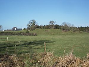
Danestown Fort facts for kids
|
Ráth Bhaile an Dainigh
|
|
 |
|
| Location | Danestown, County Meath, Ireland |
|---|---|
| Coordinates | 53°37′27″N 6°31′24″W / 53.624134°N 6.523275°W |
| Type | Ringfort |
| Area | 1,661 square metres (0.410 acres) |
| Diameter | 46 metres (151 ft) |
| History | |
| Material | earth |
| Founded | AD 500–1000 |
| Periods | Middle Ages |
| Designation | National Monument |
Danestown Fort is an ancient site in County Meath, Ireland. It is a special type of old home called a ringfort, also known as a rath. This site is very important, so it has been made a National Monument. This means it is protected by the government.
Ringforts were common homes in Ireland a long time ago. People built them between the years 500 AD and 1000 AD. They were usually circular areas surrounded by banks of earth and ditches. These features helped protect the people and their animals inside.
Where is Danestown Fort?
Danestown Fort is located in County Meath, Ireland. You can find it about 700 metres (770 yd) southeast of a village called Kentstown. The fort sits on the south bank of the Nanny River. The Nanny River is a smaller river that flows into the larger River Boyne.
What Does Danestown Fort Look Like?
Danestown Fort is a great example of a ringfort. It has a raised circular area in the middle. This inner platform is over 4 metres (13 ft) high. This was where the homes and other buildings would have been.
Around this raised area, there is a deep ditch. This ditch is called a fosse. Outside the ditch, there is another bank of earth. This outer bank is quite tall, reaching over 2 metres (6.6 ft) high in some places. Both the ditch and the banks helped to keep the fort safe.
Ringforts like Danestown Fort were built using earth. They were strong and simple homes for families in the Middle Ages. They show us how people lived and protected themselves many centuries ago in Ireland.
 | Valerie Thomas |
 | Frederick McKinley Jones |
 | George Edward Alcorn Jr. |
 | Thomas Mensah |


