
Daniels, West Virginia facts for kids
Quick facts for kids
Daniels, West Virginia
|
|
|---|---|
|
Census-designated place (CDP)
|
|

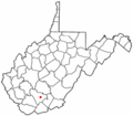
Location of Daniels, West Virginia
|
|
| Country | United States |
| State | West Virginia |
| County | Raleigh |
| Area | |
| • Total | 4.6 sq mi (12.0 km2) |
| • Land | 4.6 sq mi (12.0 km2) |
| • Water | 0.0 sq mi (0.0 km2) |
| Elevation | 2,471 ft (753 m) |
| Population
(2010)
|
|
| • Total | 1,881 |
| • Density | 409/sq mi (156.8/km2) |
| Time zone | UTC-5 (Eastern (EST)) |
| • Summer (DST) | UTC-4 (EDT) |
| ZIP code |
25832
|
| Area code(s) | 304 |
| FIPS code | 54-20164 |
| GNIS feature ID | 2389393 |
Daniels is a small community in Raleigh County, West Virginia, United States. It's called a census-designated place (CDP) because the government counts its population separately. In 2010, about 1,881 people lived there.
Where is Daniels?
Daniels is located in West Virginia, a state in the eastern United States. It's part of Raleigh County.
The community covers about 4.6 square miles (12.0 square kilometers) of land. You can find Daniels near important roads like U.S. Route 19 and Interstate 64.
People of Daniels
The United States Census Bureau collects information about people living in different areas. In 2010, the population of Daniels was 1,881 people.
A census from 2000 showed that there were 1,846 people living in Daniels. Most of the people were White (about 97.72%). A smaller number were African American, Native American, or Asian.
The median age in Daniels in 2000 was 43 years old. This means half the people were younger than 43, and half were older. About 18.9% of the population was under 18 years old.
Images for kids
-
Location of Daniels, West Virginia
See also
 In Spanish: Daniels (Virginia Occidental) para niños
