Darbalara, New South Wales facts for kids
Quick facts for kids DarbalaraNew South Wales |
|
|---|---|

Darbalara
|
|
| Postcode(s) | 2722 |
| Elevation | 303 m (994 ft) |
| Location | |
| LGA(s) | Cootamundra-Gundagai Regional Council |
| County | Buccleuch |
| State electorate(s) | Cootamundra |
| Federal Division(s) | Riverina |
Darbalara is a small, quiet community located in a beautiful part of Australia called the Riverina. It sits right where two important rivers, the Murrumbidgee River and the Tumut River, meet. You can find Darbalara about 25 kilometers (about 15 miles) northeast of a town called Gundagai and 25 kilometers south of Coolac.
What is Darbalara Like?
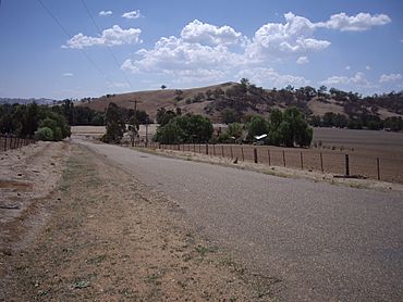
Darbalara is mostly a rural area. This means it has lots of open land and farms. People in Darbalara often raise sheep and cattle. These animals are important for meat and wool.
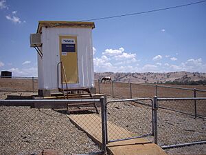
There are not many public buildings in Darbalara. The main one you might see is the telephone exchange. A telephone exchange is a special building. It helps connect phone calls between people. It makes sure calls go to the right place.
A Bit of History
Darbalara once had its own Post Office. It opened on April 25, 1912. The Post Office was a place where people could send and receive mail. It was also a meeting spot for the community. However, the Darbalara Post Office closed in 1962.
Where is Darbalara Located?
Darbalara is part of a larger area. It is located within Wagara Parish. A parish is like a small district. It is used for keeping records of land. Wagara Parish is part of Buccleuch County. This county is a way to divide up land in New South Wales.
 | Georgia Louise Harris Brown |
 | Julian Abele |
 | Norma Merrick Sklarek |
 | William Sidney Pittman |


