
Dardenne Prairie, Missouri facts for kids
Quick facts for kids
Dardenne Prairie, Missouri
|
||
|---|---|---|
|
||

Location in the state of Missouri
|
||
| Country | United States | |
| State | Missouri | |
| County | St. Charles | |
| Incorporated | 1983 (town), 2001 (city) | |
| Area | ||
| • Total | 5.32 sq mi (13.78 km2) | |
| • Land | 5.32 sq mi (13.77 km2) | |
| • Water | 0.00 sq mi (0.00 km2) 0% | |
| Elevation | 584 ft (178 m) | |
| Population
(2020)
|
||
| • Total | 12,743 | |
| • Density | 2,396.20/sq mi (925.21/km2) | |
| Time zone | UTC-6 (CST) | |
| • Summer (DST) | UTC-5 (CDT) | |
| Postal code |
63368
|
|
| Area code(s) | 636 | |
| FIPS code | 29-18253 | |
| GNIS feature ID | 2393718 | |
| Website | DardennePrairie.org | |

Dardenne Prairie is a city located in St. Charles County, Missouri, in the United States. It's a growing community with a population of 12,743 people, according to the 2020 census. The city was first incorporated as a town in 1983 and later became a city in 2001.
Contents
Geography of Dardenne Prairie
Dardenne Prairie is found southwest of O'Fallon. You can find it near Missouri Route N, just east of I-64. The city covers a total area of about 4.92 square miles (12.74 square kilometers). All of this area is land.
History of Dardenne Prairie
Dardenne Prairie was originally a large, open grassland area. This prairie stretched from near St. Peters north of Dardenne Creek. The area got its name from this creek.
What's in a Name?
The name "Dardenne" has an interesting past. Some people thought it came from the French phrase "Terre d'Inde." This phrase means "land of turkeys." However, "Terre d'Inde" actually translates to "Land of India." So, this explanation is probably not correct.
A more likely idea is that the name came from the Dardenne family. They were early pioneers in the Mississippi Valley. A person named Touissant Dardenne, from Montreal, Canada, married in 1747. It's thought that someone from this family might have camped or hunted by the creek. This could have led to the creek being named after them. Another idea is that a French trapper named the creek "Dardenne" (or d'Ardenne) to remember the Ardennes region in French Flanders.
Early Descriptions
In 1808, William Clark kept a detailed journal. He was on a trip to set up Fort Osage. Clark was famous for his Lewis and Clark Expedition. He wrote about the prairie land around Dardenne Creek:
August 25th "Set out from St. Charles, at half past 11 oClock a.m., and proceeded on, passed Several branches of the Dardan Creek a branch of the Mississippi, through a Butifull high rolling Country interspersed with plains of high grass Most of them rich & fertile, and encamped at a pond at the out Skirts of the Settlement in a butifull Plain, near a few low trees. had a Camp guard of 1st. 2d & 16 privates. Many of the Citizens visit us this evening. 21 miles".
This journal entry gives us one of the first descriptions of the beautiful prairie. It shows how the area looked to early explorers.
Population and People
| Historical population | |||
|---|---|---|---|
| Census | Pop. | %± | |
| 1990 | 1,769 | — | |
| 2000 | 4,384 | 147.8% | |
| 2010 | 11,494 | 162.2% | |
| 2020 | 12,743 | 10.9% | |
| U.S. Decennial Census | |||
Dardenne Prairie has grown a lot over the years. In 1990, there were only 1,769 people living here. By 2020, the population had grown to 12,743.
2020 Census Details
The 2020 United States census showed that Dardenne Prairie had 12,743 people. Most residents, about 85.9%, were white. There were also people of other backgrounds, including 3.7% black or African-American, 4.47% Asian, and 0.69% from other races. About 5.19% of the population identified as two or more races. People of Hispanic or Latino background made up 2.1% of the population.
The city had 4,585 households. Many households, 40.3%, had children under 18 living there. The average household had about 2.9 people. The average family size was 3.2 people. The median age in the city was 43.8 years old. About 27.3% of the population was under 18.
Education in Dardenne Prairie
Students in Dardenne Prairie attend schools in a few different districts. These include the Fort Zumwalt, Wentzville, and Francis Howell School Districts.
The city is also home to St. Charles Community College's Dardenne Creek Campus. This campus opened in 2017. It first focused on nursing and other health programs. In 2019, a second building opened. This new building, called the Field to Table Institute, teaches culinary arts and agriculture. It also offers more healthcare programs.
Notable People
- Joseph Woll, NHL Goaltender
Images for kids
-
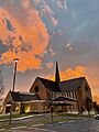
Immaculate Conception Church at sunset

See also
 In Spanish: Dardenne Prairie (Misuri) para niños
