Darrtown, Ohio facts for kids
Quick facts for kids
Darrtown, Ohio
|
|
|---|---|

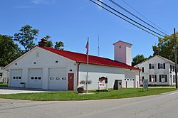
Fire station on State Route 177
|
|

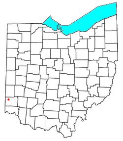
Location of Darrtown in Ohio
|
|
| Country | United States |
| State | Ohio |
| County | Butler |
| Area | |
| • Total | 2.36 sq mi (6.10 km2) |
| • Land | 2.36 sq mi (6.10 km2) |
| • Water | 0.00 sq mi (0.00 km2) |
| Elevation | 751 ft (229 m) |
| Population
(2020)
|
|
| • Total | 514 |
| • Density | 218.17/sq mi (84.23/km2) |
| Time zone | UTC-5 (Eastern (EST)) |
| • Summer (DST) | UTC-4 (EDT) |
| ZIP code |
45056
|
| FIPS code | 39-20268 |
| GNIS feature ID | 2584361 |
Darrtown is a small community located in Butler County, Ohio, in the United States. It is known as a census-designated place (CDP). This means it's an area that the government counts for the census, but it's not officially a city or town with its own local government. In 2020, about 514 people lived there.
Contents
What is Darrtown's History?
Darrtown was started in 1814 by a person named Conrad Darr. The community was named after him. A post office opened in Darrtown in 1825. It helped people send and receive mail for many years. The post office stayed open until 1907.
Where is Darrtown Located?
Darrtown is in the northwestern part of Butler County, Ohio. It sits in a valley near a stream called Four Mile Creek. This area is in the southwest part of Milford Township.
How to Get Around Darrtown
Ohio State Route 177 is a main road that goes right through Darrtown. This road can take you to other places nearby. For example, it leads about 8 miles (13 km) southeast to the city of Hamilton, Ohio. If you go west for about 5 miles (8 km) on Route 177 and Ohio State Route 73, you will reach Oxford, Ohio.
How Big is Darrtown?
The total area of Darrtown is about 6.1 square kilometers (2.36 square miles). All of this area is land, meaning there are no large bodies of water like lakes or big rivers within its borders.
How Many People Live in Darrtown?
The number of people living in Darrtown is counted during the United States Census. Here's how the population has changed:
| Historical population | |||
|---|---|---|---|
| Census | Pop. | %± | |
| 2020 | 514 | — | |
| U.S. Decennial Census | |||
Who is a Famous Person from Darrtown?
One well-known person connected to Darrtown is Walter Alston. He was a famous baseball player and manager. He played for the Saint Louis Cardinals and later became a very successful manager for the Los Angeles Dodgers.
See also
 In Spanish: Darrtown (Ohio) para niños
 | Misty Copeland |
 | Raven Wilkinson |
 | Debra Austin |
 | Aesha Ash |

