Degaña facts for kids
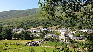
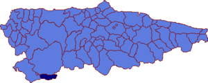
Degaña is a small area in the Asturias region of Spain. It's known as a municipality, which is like a local government area. In 2023, about 805 people lived there. Degaña is nestled in the Cantabrian Mountains, a beautiful mountain range.
It shares its borders with Cangas del Narcea to the north, Castile and León to the south, and Ibias to the west. The Ibias River flows through much of this region. Degaña is also the name of one of the three main parts, or parishes, within the municipality. The other two parishes are Zarréu and Trabáu.
Quick facts for kids
Degaña
|
||
|---|---|---|

Parish of Degaña
|
||
|
||
 |
||
| Country | ||
| Autonomous community | ||
| Province | Asturias | |
| Comarca | Narcea | |
| Judicial district | Cangas del Narcea | |
| Area | ||
| • Total | 87.16 km2 (33.65 sq mi) | |
| Highest elevation | 1,934 m (6,345 ft) | |
| Population
(2023)
|
||
| • Total | 805 | |
| • Density | 9.236/km2 (23.921/sq mi) | |
| Demonym(s) | degañés | |
| Time zone | UTC+1 (CET) | |
| • Summer (DST) | UTC+2 (CEST) | |
| Postal code |
33812
|
|
A Look Back at Degaña's History
Not much is known about Degaña's early history. This is because it was a very remote place. It also had very few people living there for a long time.
In 1863, Degaña became its own separate municipality. Before that, it was part of a larger area called Ibias. The name "Degaña" came from the parish of Degaña. This parish was the biggest settlement in the area at that time.
During the Spanish Civil War, which was a big conflict in Spain, there were some important events in the Degaña area. After the war, something big changed the region. People found a lot of coal underground. This led to coal mining becoming the most important industry. Because of the mines, the parish of Zarréu grew a lot. It even became more populated than Degaña itself.
Degaña Today: Challenges and New Ideas
After many years, a lot of the coal mines in the Degaña area started to close down. This was a big problem for the region. Many people lost their jobs. As a result, Degaña's population began to shrink. Since 1996, almost half of the people have moved away.
To help fix this situation, the Spanish government stepped in. In 2023, the Ministry of Environment started a special plan. This plan aims to bring new life to Degaña and Ibias. They want to encourage ecotourism. This means people would visit to enjoy nature and the environment.
They also want to promote something called counterurbanization. This is when people move from big cities to smaller, rural areas. The main goal of this plan is to help the region's economy grow again. They hope to create new jobs and bring more people to Degaña.
See also
 In Spanish: Degaña para niños
 | Delilah Pierce |
 | Gordon Parks |
 | Augusta Savage |
 | Charles Ethan Porter |


