Del Paso Heights, Sacramento, California facts for kids
Quick facts for kids
Del Paso Heights, California
|
|
|---|---|
|
Neighborhood of Sacramento
|
|
| Nickname(s):
The Heights, D.P.H., Del Paso
|
|
| Motto(s):
2's Up
|
|
| Country | United States |
| State | California |
| County | Sacramento |
| City | Sacramento |
| Elevation | 52 ft (16 m) |
| GNIS ID | 1658397 |
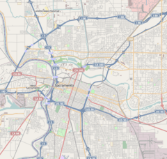
Del Paso Heights is a neighborhood in the city of Sacramento, located in Sacramento County, California, United States. It's like a special part of Sacramento. This area has clear boundaries. To the north, you'll find the Beltline Freeway, also known as Interstate 80. Norwood Avenue is on its west side. To the south, there's Arcade Creek. And on the east, you'll see Roseville Road. Del Paso Heights is in an area of Sacramento called Area 4. This means it's located north of the American River.
Contents
A Look Back: History of Del Paso Heights
Del Paso Heights has an interesting past. It was once part of a huge piece of land called Rancho Del Paso. This land was given to Eliab Grimes by Mexico in 1844. It was about 44,000 acres, which is a very large area!
Ranch Life and Horse Racing
Later, in 1862, a person named James Ben Ali Haggin bought this land. He turned the ranch into a special farm for breeding fast horses called thoroughbreds. One of the horses from this farm even won the Kentucky Derby in 1886. This was the first time a horse from California won this famous race!
Growing Community
Del Paso Heights used to be part of a larger area called "Del Paso Heights-Robla." In 1960, about 11,495 people lived there. This shows how the community has grown over time.
Where is Del Paso Heights?
Del Paso Heights is located at specific coordinates: 38.6360152 degrees north and 121.4202312 degrees west. You can also think of its location using landmarks.
Neighborhood Borders
The area stretches from north to south. In the north, you'll find Interstate 80. In the south, it reaches Arcade Creek. From east to west, it goes from Marysville Boulevard to Western Avenue.
Nearby Areas
Right next to Del Paso Heights is another community called North Sacramento. North Sacramento is bordered by Arcade Creek to the north and Arden Way to the south. Auburn Boulevard is on its east side, and Western Avenue is on its west side.
 | James B. Knighten |
 | Azellia White |
 | Willa Brown |


