Deming Woods, Indiana facts for kids
Quick facts for kids
Deming Woods, Indiana
|
|
|---|---|

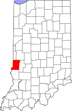
Vigo County's location in Indiana
|
|
| Country | United States |
| State | Indiana |
| County | Vigo |
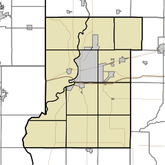
| Township | Harrison |
| Elevation | 548 ft (167 m) |
| Time zone | UTC-5 (Eastern (EST)) |
| • Summer (DST) | UTC-4 (EDT) |
| ZIP code |
47803
|
| Area code(s) | 812, 930 |
| GNIS feature ID | 433466 |
Deming Woods is a small, unincorporated community located in Vigo County, Indiana, in the U.S. state of Indiana. Being "unincorporated" means it's a place with a shared identity but without its own local government. Instead, it's managed by the larger Harrison Township.
This community is found in the eastern part of Harrison Township. It's also considered part of the Terre Haute metropolitan area. This means it's close to the city of Terre Haute and shares some of its services and economy.
Where is Deming Woods?
Deming Woods is located at specific geographic coordinates: 39 degrees, 27 minutes, 36 seconds North latitude and 87 degrees, 21 minutes, 28 seconds West longitude. These numbers help pinpoint its exact spot on a map.
The community sits at an elevation of 548 feet (or 167 meters) above sea level. This measurement tells us how high the land is compared to the ocean's surface.
 | DeHart Hubbard |
 | Wilma Rudolph |
 | Jesse Owens |
 | Jackie Joyner-Kersee |
 | Major Taylor |


