Deo, Bihar facts for kids
Quick facts for kids
Deo
|
|
|---|---|
|
Town
|
|

|
|
| Country | India |
| State | Bihar |
| District | Aurangabad 1973 - Now |
| Block | Deo (community development block) |
| Subdistrict | Aurangabad |
| Division | Magadh |
| Founded by | King of Deo Town |
| Named for | DEO |
| Government | |
| • Body | MLA |
| Area rank | 2 |
| Elevation | 89 m (292 ft) |
| Population
(2011)
|
|
| • Total | 17,162 |
| Time zone | UTC+5:30 (IST) |
| PIN |
824202
|
Deo, also known as Dev, is a town located in the Aurangabad district of Bihar, India. It is about 10 kilometers (6 miles) southeast of the main Aurangabad city. Deo is an important place with its own town council.
Contents
About Deo's Location
Deo is found at specific geographical coordinates: 24°23′N 84°16′E / 24.39°N 84.26°E. The town sits about 89 meters (291 feet) above sea level. This elevation helps describe its position on the land.
People and Population
According to the 2001 census in India, Deo had a population of 173,216 people. Out of these, 89,280 were males and 83,936 were females.
Deo has a high literacy rate of 89%. This is much higher than the national average of 59.5% at that time. About 75% of males could read and write, while 61% of females could. Also, 29% of the population in Deo was under 6 years old. There were 27,596 households in total.
Getting Around Deo
Deo has a good network of roads. These roads connect the town to other parts of Bihar and the rest of India. The famous Grand Trunk Road, which goes from Kolkata to Delhi, passes about 4 kilometers (2.5 miles) from Deo. This road is now known as National Highway 19.
Places to Visit in Deo
Deo is home to several interesting places that you might enjoy visiting.
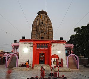
Deo Sun Temple
The Deo Sun Temple is a famous Hindu temple in Deo. It is dedicated to the sun god, Surya. This temple is a significant religious site in the region.
Deo Fort
The Deo Fort is another historical landmark located in Deo. It stands as a reminder of the town's past.
Biodiversity Park, Deo
Deo is also home to the first biodiversity park in Aurangabad. This park is located in Bharkur village and covers about 15 acres of land. It is a great place to see different types of plants and animals.
Schools and Colleges in Deo
Deo has several educational institutions that help students learn and grow.
- Raja Jagannath High School, Deo
- Rani Brajraj Kumari Project High School, Deo
- Maharana Pratap College, Deo
Notable People from Deo
- Rajan Singh was a former member of the Bihar Legislative Council. This council is part of the government in Bihar.
 | Tommie Smith |
 | Simone Manuel |
 | Shani Davis |
 | Simone Biles |
 | Alice Coachman |


