Derna, Libya facts for kids
Quick facts for kids
Derna
درنة
|
|
|---|---|
|
Overview of Derna
|
|
| Country | |
| Region | Cyrenaica |
| District | Derna |
| Population
(2023)
|
|
| • Total | 90,000 |
| Time zone | UTC+2 (EET) |
| License Plate Code | 10 |
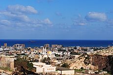
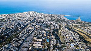
Derna (pronounced DUR-nuh) is a port city in eastern Libya. About 90,000 people live there. Derna was once a very rich area among the Barbary States. Today, it is the main city of the Derna District.
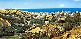
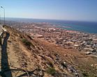
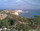
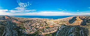
Derna has a special location. It sits between the Green Mountain, the Mediterranean Sea, and the desert. It is also an important port on Libya's northern coast. Many people from different backgrounds call Derna home.
The city was the site of the famous Battle of Derna in 1805. This was the first time the United States Military won a battle on foreign land. It happened during the First Barbary War.
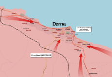
In October 2014, parts of Derna were taken over by a group called the Islamic State. By June 2015, another group, the Shura Council of Mujahideen in Derna, took control. Later, the Libyan National Army took over the city in 2019.
In September 2023, a huge flood hit Derna. Two dams on the Wadi Derna river broke during Storm Daniel. This caused a quarter of the city to be washed away. Thousands of people died or went missing.
Contents
What's in a Name?
The city's old Greek names were Darnis and Darne. Sometimes it was wrongly called Dardanis. When the Romans ruled, it was known as Darnis and Derna. Under Arab rule, it was called Derneh or Terneh.
Derna's Past: A Journey Through Time
Ancient Times and the Middle Ages
Long ago, during the Hellenistic period, the ancient city of Darnis was part of a group of five Greek cities in Libya. Under the Roman Empire, it became an important city for both government and religion. We know the names of some of its early religious leaders from old papers.
Later, in 1493, people from Islamic Spain came to Derna. They rebuilt the city on the old settlement's site.
Modern History: From Ottomans to Today
Ottoman Rule
Derna was part of the Ottoman Empire for a long time. At first, it was ruled from Tripoli. Then, it came under the Karamanli dynasty until 1835. After that, it was governed from Constantinople (now Istanbul).
In the 1850s, about 4,500 people lived in Derna. They made a living by farming, fishing, and trading along the coast.
The oldest mosque in Derna is called Al-masjeed al-ateeq, or the "Old Mosque." It was fixed up in 1772. It has 42 small domes because it was hard to find wood or stone in that area. Another mosque, Masjeed az-zawiyah, was built in 1846.
In 1805, Derna was the site of the Battle of Derne. American forces, led by William Eaton, marched 500 miles across the desert. They captured the city during the First Barbary War. This was a big victory for the United States.
Italian Control
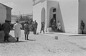
On October 16, 1911, Italian soldiers took control of Derna during the Italo-Turkish War. The Italians ruled Derna for about 29 years. Then, during World War II, Australian troops captured it in 1941. German forces took it back, but British forces recaptured it later that same year.
Recent Times and Challenges
After the Libyan civil war began in 2011, Derna came under the control of the National Transitional Council. This group was against the old Libyan government.
In October 2014, a group called the Islamic Youth Shura Council took control of parts of the city. They were connected to the Islamic State. By June 2018, forces loyal to Khalifa Haftar took full control of Derna after a long fight.
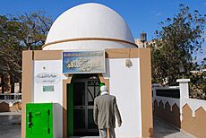
Mausoleum of a Sahaba before its destruction
|
The Impact of Storm Daniel
On September 10, 2023, Storm Daniel hit Libya. It brought very heavy rain and caused extreme flooding in Derna. The government declared a state of emergency. Early the next day, two dams, the Derna dam and the Mansour dam, broke. This sent huge amounts of water rushing into the city, especially around the Wadi Derna river.
The flood caused a lot of damage. About 25% of Derna was washed away into the sea. Thousands of people died, and many more were injured or went missing.
Derna's Geography
Derna is located at the eastern end of the Green Mountain. This is one of the few forested areas in Libya. Libya is mostly dry, with only a tiny part covered by forests. However, Derna is near a fertile area that gets a lot of rain, about 600 millimeters (24 inches) each year. This makes it the wettest region in the country.
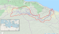
The city is built along the Wadi Derna, which is a river that is usually dry for most of the year. In the past, floods have often damaged the city. Two dams, the Abu Mansur and Derna dams, were built upstream to help control floods. But in September 2023, both dams broke during Storm Daniel. This made the flood much worse and caused a lot of damage and loss of life in Derna.
Derna is connected to Shahhat by two roads. One road goes through Al Qubah and is part of the main Libyan Coastal Highway. The other road follows the coast through Susa and Ras al Helal.
Derna's Weather
Derna has a hot semi-arid climate. This means it's generally dry, but it gets some rain, mostly between October and March. The city gets about 275 millimeters (11 inches) of rain each year. Because it's by the sea, its temperatures don't change as quickly as inland areas. However, the nearby Sahara Desert can still cause very hot days.
In winter, the average temperature is between 9 and 20 degrees Celsius (48 and 68 degrees Fahrenheit). Summers are long and very dry. Afternoon temperatures are usually above 27 degrees Celsius (81 degrees Fahrenheit) from June to October.
| Climate data for Derna, Libya | |||||||||||||
|---|---|---|---|---|---|---|---|---|---|---|---|---|---|
| Month | Jan | Feb | Mar | Apr | May | Jun | Jul | Aug | Sep | Oct | Nov | Dec | Year |
| Record high °C (°F) | 29.6 (85.3) |
32.8 (91.0) |
35.8 (96.4) |
38.3 (100.9) |
44.0 (111.2) |
44.8 (112.6) |
41.7 (107.1) |
43.5 (110.3) |
40.6 (105.1) |
39.0 (102.2) |
37.8 (100.0) |
30.6 (87.1) |
44.8 (112.6) |
| Mean daily maximum °C (°F) | 17.5 (63.5) |
18.2 (64.8) |
19.4 (66.9) |
21.7 (71.1) |
24.3 (75.7) |
27.3 (81.1) |
28.2 (82.8) |
29.1 (84.4) |
28.1 (82.6) |
26.1 (79.0) |
23.1 (73.6) |
19.2 (66.6) |
23.5 (74.3) |
| Daily mean °C (°F) | 14.1 (57.4) |
14.5 (58.1) |
15.6 (60.1) |
17.7 (63.9) |
20.3 (68.5) |
23.5 (74.3) |
25.3 (77.5) |
26.1 (79.0) |
25.0 (77.0) |
22.4 (72.3) |
19.3 (66.7) |
15.7 (60.3) |
20.0 (68.0) |
| Mean daily minimum °C (°F) | 10.7 (51.3) |
10.8 (51.4) |
11.7 (53.1) |
13.8 (56.8) |
16.2 (61.2) |
19.7 (67.5) |
22.3 (72.1) |
23.2 (73.8) |
21.9 (71.4) |
18.6 (65.5) |
15.5 (59.9) |
12.2 (54.0) |
16.4 (61.5) |
| Record low °C (°F) | 4.4 (39.9) |
4.4 (39.9) |
5.0 (41.0) |
6.7 (44.1) |
8.7 (47.7) |
8.3 (46.9) |
10.0 (50.0) |
18.3 (64.9) |
14.5 (58.1) |
10.0 (50.0) |
8.3 (46.9) |
6.7 (44.1) |
4.4 (39.9) |
| Average rainfall mm (inches) | 60 (2.4) |
39 (1.5) |
28 (1.1) |
10 (0.4) |
6 (0.2) |
2 (0.1) |
0 (0) |
0 (0) |
4 (0.2) |
32 (1.3) |
36 (1.4) |
57 (2.2) |
274 (10.8) |
| Average rainy days (≥ 0.1 mm) | 11 | 8 | 7 | 3 | 2 | 0 | 0 | 0 | 1 | 5 | 6 | 5 | 48 |
| Average relative humidity (%) | 76 | 72 | 74 | 74 | 74 | 75 | 80 | 80 | 75 | 74 | 75 | 78 | 76 |
| Mean monthly sunshine hours | 151.9 | 189.3 | 204.6 | 231.0 | 282.1 | 297.0 | 316.2 | 297.6 | 237.0 | 223.2 | 189.0 | 145.7 | 2,764.6 |
| Mean daily sunshine hours | 4.9 | 6.7 | 6.6 | 7.7 | 9.1 | 9.9 | 10.2 | 9.6 | 7.9 | 7.2 | 6.3 | 4.7 | 7.7 |
| Source 1: Deutscher Wetterdienst | |||||||||||||
| Source 2: Arab Meteorology Book (sun only) | |||||||||||||
City Layout and Sights
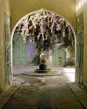
Derna has three main squares. The most well-known is Maydan Assahabah. This square was often used for large public gatherings. The city is also a good place for tourists to visit. This is because of its old city, called the Medina, which has beautiful Islamic buildings.
 | William Lucy |
 | Charles Hayes |
 | Cleveland Robinson |


