Dhaulagiri Zone facts for kids
Quick facts for kids
Dhaulagiri Zone
धौलागिरी अञ्चल
|
|
|---|---|

Dhaulagiri Zone
|
|
| Country | |
| Area | |
| • Total | 8,148 km2 (3,146 sq mi) |
| Population
(2001)
|
|
| • Total | 556,191 |
| • Density | 68.261/km2 (176.795/sq mi) |
| Time zone | UTC+5:45 (Nepal Time) |
Dhaulagiri (Nepali: धौलागिरी अञ्चल) was a special area in Nepal. It was one of 14 "zones" that Nepal used to divide itself for how it was run. This changed on September 10, 2015, when Nepal got a new plan and divided the country into 7 "provinces" instead.
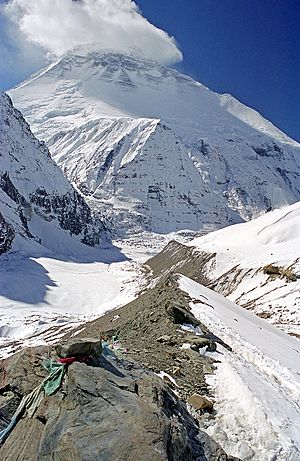
Dhaulagiri Zone was located in the western part of Nepal. Its main city, or "headquarters," was Baglung. This zone was famous for some amazing places. You could find popular trekking spots like Mustang, Muktinath, and the Kali Gandaki valley here. The mighty Mt Dhaulagiri also stood tall in this zone.
One very special place in Dhaulagiri Zone was the Dhorpatan Hunting Reserve. This is the only place in Nepal where people are allowed to hunt in a controlled way. This reserve stretched across two districts: Baglung and Myagdi.
What was Dhaulagiri Zone like?
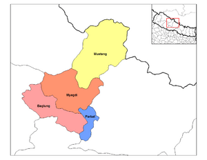
Dhaulagiri Zone was made up of four smaller areas called districts. After 2015, these districts became part of a new area called Gandaki Province.
Here are the districts that were once part of Dhaulagiri Zone:
- Baglung District: This was a "Hill" district, meaning it had many hills and valleys. Its main town was Baglung.
- Mustang District: This was a "Mountain" district, known for its high mountains. Its main town was Jomsom.
- Myagdi District: Another "Hill" district, with its main town being Beni.
- Parbat District: Also a "Hill" district, with its main town called Kusma.
All these districts are now part of Gandaki Province.

See also
 In Spanish: Zona de Dhaulagiri para niños
 | Chris Smalls |
 | Fred Hampton |
 | Ralph Abernathy |

