Dhofar Governorate facts for kids
Quick facts for kids
Dhofar Governorate
مُحَافَظَة ظُفَّار
|
|
|---|---|
| Muḥāfaẓat Ẓuffār | |
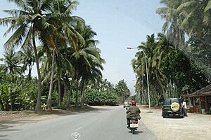
Coconut trees in the coastal area of Salalah
|
|
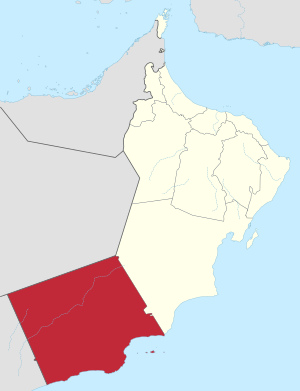
Map of Oman with the Dhofar Governorate highlighted
|
|
| Capital | Salalah |
| Wilayat (districts) | 10 |
| Area | |
| • Total | 99,300 km2 (38,300 sq mi) |
| Population
(September 2021)
|
|
| • Total | 408,419 |
| • Density | 4.1130/km2 (10.653/sq mi) |
| Postal code |
211
|
| ISO 3166 code | OM-ZU |
| Website | www.dm.gov.om |
The Dhofar Governorate (Arabic: مُحَافَظَة ظُفَّار, romanized: Muḥāfaẓat Ẓuffār) is the biggest region in the country of Oman. It is located in southern Oman, sharing borders with Yemen and Saudi Arabia. Dhofar is a mostly mountainous area. It covers about 99,300 square kilometers. In 2020, about 416,458 people lived there.
Salalah is the largest city and the capital of Dhofar. Long ago, this region was famous for its frankincense. The people here speak a special kind of Arabic called Dhofari Arabic. It sounds different from the Arabic spoken in other parts of Oman and Yemen.
Contents
A Look at Dhofar's Past
Ancient Discoveries
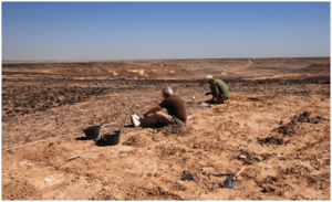
In 2011, scientists found an amazing site called Aybut Al-Auwal. It was in a valley called Wadi Aybut. They found over 100 groups of stone tools there. These tools were from a very old type of stone tool-making. It was called the Nubian Complex. Before this, these tools were only known from Northeast Africa.
Scientists used a special method to find out how old the tools were. They learned the tools were about 106,000 years old. This shows that a special Middle Stone Age tool style existed in southern Arabia. Older sites from the Bronze Age were also found. These included ancient tombs at a place called Hodor.
Dhofar in Olden Days
A famous traveler named Marco Polo wrote about Dhofar around the year 1300. He said Dhofar was a "great and noble and fine city." He mentioned that a lot of white frankincense came from there. He explained how it grew from trees that looked like small fir trees. People would cut the trees, and the frankincense would ooze out. Sometimes, it would flow out on its own because of the strong sun.
Dhofar was a major place for selling frankincense in ancient times. Some of it was even traded as far away as China.
Near Salalah, there's a place called Al-Baleed Archaeological Park. It has many old ruins. This area was once home to the Manjawi Civilization. This civilization lived there from the 12th to the 16th centuries.
Before Oman ruled Dhofar, parts of it were controlled by the Kathiri sultanate. Later, local tribes like Al-Hakli (Qara) mostly ruled the area. This is why the Dhofar Mountains are sometimes called the "Qara Mountain Range." The Al-Shahri people are thought to be the first people to live in Dhofar.
Dhofar in the 19th and 20th Centuries
In 1876, a man named Sayyid Fadhl bin Alawi came to Dhofar. He became the leader of the area. He said he was loyal to the Ottoman Empire. With help from local tribes, he fought against people living in the desert. But local leaders forced him to leave in 1879.
A British report from 1917 described Dhofar. It said Dhofar was between the Samhan hills and the sea. It noted that Dhofar had plains, mountains, and valleys. The villages of Al Haffah and Salalah held most of the people.
It was hard to travel outside Dhofar because of the rough land. There were no big harbors. Frankincense was the main product traded. Other goods included animal hides and beeswax. People imported things like rice, sugar, and cloth.
In 1943, an essay by Gordon Noel Jackson explained how Dhofar was managed. The Sultan of Muscat himself ran Dhofar. He treated it more like his own property than a regular province. During World War I, Dhofar was fertile. It produced enough food to help supply the British Army fighting far away.
Later, from 1963 to 1976, there was a conflict in Dhofar. The Sultan of Oman's army fought against local groups. These groups wanted to change the government. The Sultan's forces, with help from other countries, won the conflict in 1975.
Who Lives in Dhofar?
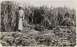
In 1908, a report by J.G. Lorimer said that the two main tribes in Dhofar were the Al Qara and Al Kathiri. The Al Qara lived in the mountains. The Al Kathiri lived in both the hills and villages. Both tribes spoke types of Arabic that were not known in other parts of Arabia. Other important tribes included the Ja'afar and Sayid. Most people in Dhofar were farmers. They were also known for using a plant called 'khat'. At that time, Dhofar had about 11,000 people. Most of them were Bedouins, who are nomadic people.
In 1943, Gordon Noel Jackson wrote that the people of Dhofar were as varied as the landscape. He said the "mountain Arabs" moved around a lot. They did not speak Modern Standard Arabic well. He also noted they were not very strict about Islamic customs. They were quite superstitious and followed old traditions. They did not farm much because the land was dry. Instead, they traded incense and raised animals.
Today, many Arabic speakers from the main culture of Oman live in Dhofar. They mostly live in the larger cities and towns. But Dhofar is also the traditional home of many tribes who speak Modern South Arabian languages. One of these languages is Shehri, also called Jibbali (meaning "Mountainous"). It is spoken by tribes like Al-Hakli and Al-Shahri. Other groups speak smaller languages like Bat'hari.
| Historical population | ||
|---|---|---|
| Census year | Pop. | ±% p.a. |
| 1993 | 189,094 | — |
| 2003 | 215,960 | +1.34% |
| 2010 | 249,729 | +2.10% |
| 2020 | 416,458 | +5.25% |
| Source: Citypopulation | ||
Dhofar's Unique Landscape
Mountains, Plains, and Water
Dhofar Governorate is in the very west of Oman. The Indian Ocean is to its south. The Dhofar Mountains form a half-circle, blocking it off from the deserts to the north, east, and west.
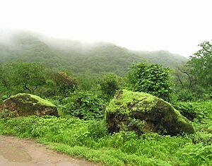
Dhofar is special because it gets monsoon rain for about three months each year. This is called the Khareef. Monsoon clouds from the Indian Ocean get trapped by the mountains over the Dhofar plain. This makes Dhofar cooler and more humid in summer.
The region has three main types of land:
- A farmed area along the coast.
- A desert plain that separates the coast from the mountains.
- The mountains themselves.
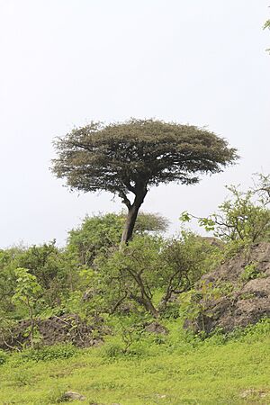
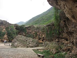
The mountains are steep in some places. They have cliffs and deep valleys. But on top, there are rolling grassy areas. There are also wide, park-like valleys with many trees. These include wild figs, tamarinds, and acacias. Many wild flowers and grasses grow here. This provides lots of food for cows, camels, and goats in the summer.
The mountains gently rise to about 3,000 to 4,000 feet high. Then they slope down to the north. This northern side is drier and has fewer clouds. This is where the famous frankincense trees grow wild. The dry air helps make the best quality frankincense.
Even though the southern slopes get good rain, the soil doesn't hold water well. Underground rivers flow into Wadi Darbat. These waters fill a lake two miles long. During the rains, the lake overflows, creating a beautiful waterfall. Other underground rivers feed natural springs at the bottom of the hills. There are six of these springs. Jarziz is the best one, producing about 40,000 gallons of water every hour!
Climate and Forests
Dhofar has a tropical climate. It gets the South East monsoon from mid-June to mid-September. This is the Khareef season. The monsoon clouds keep the summer cool and wet. The winter months are warm, except when cold winds bring dust storms and a drop in temperature. Dhofar's heavy seasonal rain is very different from the dry Empty Quarter Desert nearby. The Salalah plain used to be a well-farmed area with a good irrigation system.
Dhofar's forests were once very large. In 1989, they covered about 53,000 hectares. But by 2020, they had shrunk to 10,000 hectares. This was due to human activities and cutting down trees. These forests are home to over 750 types of plants. About 50 of these plants are found only in Dhofar. This means Dhofar has more than 75% of Oman's plant life!
Culture and Interesting Places
Dhofar has a strong tribal community. The Al-Kathiri tribe is the largest in Salalah and Dhofar. Other tribes include Al-Hakli (Qara), Hashimi, Al-Yafei, and Al-Shahri. Many people from other countries also live here.
Salalah, the capital city, has an international airport. It also has one of the biggest seaports in the Middle East. You can find several resorts there, like the Marriott and Crowne Plaza hotels. There's also a university. The Burj-al-Nadha clock tower is a famous local landmark. It is even on the Dhofar Municipality's coat of arms.
The Dhofar region is also known for its many meteorites.
Some people believe that the coasts of Dhofar, perhaps Wadi Sayq, might be the place called Bountiful in the Book of Mormon. This is where a family named Lehi built a ship and sailed to a new world around 600 BC.
How Dhofar is Governed
Dhofar's Provinces
Dhofar Governorate is divided into ten smaller areas called wilayats or provinces. Al-Mazyunah is the newest province. It was named after the mother of Sultan Qaboos bin Said Al Said. Each wilayat has several villages and towns.
Here are the ten wilayats of Dhofar:
- Al-Mazyūnah (Arabic: ٱلْمَزْيُوْنَة), population (2017): 9,261
- Ḍalkūt (Arabic: ضَلْكُوْت), population (2017): 2,988
- Mirbat (Arabic: مرباط), population (2017): 16,307
- Muqshin (Arabic: مُقْشِن), population (2017): 857
- Rakhyūt (Arabic: رَخْيُوْت), population (2017): 5,049
- Sadah (Arabic: سدح), population (2017): 5,944
- Salalah (capital of the Governorate) (Arabic: صَلَالَة), population (2017): 374,582
- Shalim and the Hallaniyat Islands (Arabic: جزر خوريا موري), population (2017): 4,792
- Taqah (Arabic: طاقة), population (2017): 20,876
- Thumrait (Arabic: ثمريت), population (2017): 16,966
Villages in Dhofar
Many villages are found in Dhofar, especially along the coast and near the main towns. An old report from 1917 described the locations, geography, and history of several of these villages.
Dhofar's Economy
Mining for Resources
Dhofar has some mining activities. For example, the Shuwaymiya mine produces gypsum.
See also
- Bountiful (Book of Mormon)
- Rism


