Dietwiller facts for kids
Quick facts for kids
Dietwiller
|
||
|---|---|---|
|
||
| Country | France | |
| Region | Grand Est | |
| Department | Haut-Rhin | |
| Arrondissement | Mulhouse | |
| Canton | Sierentz | |
| Intercommunality | Mulhouse Alsace Agglomération | |
| Area
1
|
11.06 km2 (4.27 sq mi) | |
| Population
(2006)
|
1,347 | |
| • Density | 121.79/km2 (315.44/sq mi) | |
| Time zone | UTC+01:00 (CET) | |
| • Summer (DST) | UTC+02:00 (CEST) | |
| INSEE/Postal code |
68072 /68440
|
|
| Elevation | 240–304 m (787–997 ft) (avg. 250 m or 820 ft) |
|
| 1 French Land Register data, which excludes lakes, ponds, glaciers > 1 km2 (0.386 sq mi or 247 acres) and river estuaries. | ||
Dietwiller is a small and charming commune, which is like a local town or village area, located in eastern France. It is part of the Haut-Rhin department. This region is known for its beautiful landscapes and rich history.
Contents
Where is Dietwiller Located?
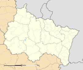
Dietwiller is found in the Haut-Rhin department. This department is in the Grand Est region of France. It is close to the borders with Germany and Switzerland. This makes Dietwiller part of a culturally diverse area.
What is a Commune?
A commune is the smallest administrative division in France. Think of it as a local government area, similar to a township or a small municipality. Each commune has its own mayor and local council. They manage local services and represent the people living there.
How Big is Dietwiller?
Dietwiller covers an area of about 11.06 square kilometers. This is roughly 4.27 square miles. It is a relatively small area, making it easy to explore.
Who Lives in Dietwiller?
As of 2006, Dietwiller had a population of 1,347 people. This means it is a small community. Small towns often have a close-knit feel.
What is the Population Like Today?
While the 2006 data gives us a snapshot, populations can change. Small towns like Dietwiller often see slow but steady growth. People might move there for a quieter life.
What is the Geography of Dietwiller Like?
Dietwiller is situated at an elevation of about 250 meters (820 feet) above sea level. The lowest point in the commune is 240 meters (787 feet). The highest point reaches 304 meters (997 feet). This shows that the land has some gentle hills.
What Does "Elevation" Mean?
Elevation tells us how high a place is above sea level. Knowing the elevation helps us understand the local landscape. It can also influence the climate and types of plants that grow there.
Who is in Charge of Dietwiller?
The mayor of Dietwiller is Robert Riss. He served from 2008 to 2014. The mayor is the head of the local government. They are responsible for the daily running of the commune.
What Does a Mayor Do?
A mayor is like the leader of the town. They oversee public services such as schools, roads, and local events. They also represent the commune in larger regional meetings. Mayors are elected by the people living in the commune.
What is Intercommunality?
Dietwiller is part of Mulhouse Alsace Agglomération. This is an "intercommunality." It means several communes work together on shared projects. These projects might include public transport, waste management, or economic development. Working together helps small communes achieve more.
See also
 In Spanish: Dietwiller para niños
 | John T. Biggers |
 | Thomas Blackshear |
 | Mark Bradford |
 | Beverly Buchanan |


