Dillsboro, Indiana facts for kids
Quick facts for kids
Dillsboro, Indiana
|
|
|---|---|
 |
|

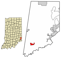
Location of Dillsboro in Dearborn County, Indiana.
|
|
| Country | United States |
| State | Indiana |
| County | Dearborn |
| Township | Clay |
| Area | |
| • Total | 1.33 sq mi (3.45 km2) |
| • Land | 1.33 sq mi (3.45 km2) |
| • Water | 0.00 sq mi (0.00 km2) |
| Elevation | 876 ft (267 m) |
| Population
(2020)
|
|
| • Total | 1,360 |
| • Density | 1,020.26/sq mi (393.90/km2) |
| Time zone | UTC-5 (EST) |
| • Summer (DST) | UTC-4 (EDT) |
| ZIP code |
47018
|
| Area code(s) | 812 |
| FIPS code | 18-18190 |
| GNIS feature ID | 2396687 |
| Website | http://www.townofdillsboro.com |
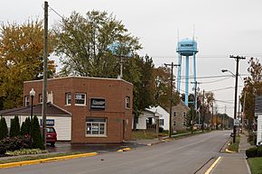
Dillsboro is a small town located in Dearborn County, Indiana, in the United States. It is part of Clay Township. In 2020, about 1,360 people lived there.
Contents
Dillsboro's History
Dillsboro was planned and started in 1830. The town was named after James Dill. He was a general during the War of 1812 and lived in the area.
The town's post office opened in 1837. For many years, its name was spelled "Dillsborough" until 1893, when it changed to "Dillsboro".
Geography and Climate
Where is Dillsboro?
In 2010, Dillsboro covered about 1 square mile (2.59 km2) of land. There was no water area within the town limits.
What is Dillsboro's Climate Like?
The weather in Dillsboro has hot and humid summers. Winters are usually mild to cool. This type of weather is called a humid subtropical climate. On climate maps, you might see it marked as "Cfa".
Population Changes
| Historical population | |||
|---|---|---|---|
| Census | Pop. | %± | |
| 1880 | 432 | — | |
| 1890 | 439 | 1.6% | |
| 1900 | 465 | 5.9% | |
| 1910 | 425 | −8.6% | |
| 1920 | 471 | 10.8% | |
| 1930 | 502 | 6.6% | |
| 1940 | 558 | 11.2% | |
| 1950 | 681 | 22.0% | |
| 1960 | 745 | 9.4% | |
| 1970 | 840 | 12.8% | |
| 1980 | 1,038 | 23.6% | |
| 1990 | 1,200 | 15.6% | |
| 2000 | 1,436 | 19.7% | |
| 2010 | 1,327 | −7.6% | |
| 2020 | 1,360 | 2.5% | |
| U.S. Decennial Census | |||
People in Dillsboro (2010)
According to the census from 2010, there were 1,327 people living in Dillsboro. These people lived in 520 households, and 320 of these were families.
Most of the people in Dillsboro were White (98.6%). A small number were African American, Native American, or Pacific Islander. Some people were also from two or more races.
The average age of people in Dillsboro was about 42 years old.
- About 23% of residents were under 18 years old.
- About 24% of residents were 65 years or older.
- More than half of the residents (55.4%) were female.
Important Buildings
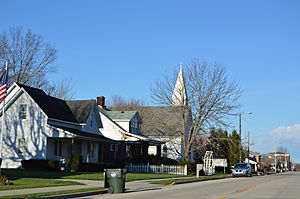
The Hopewell Presbyterian Church building was built in 1888. However, the church group itself started much earlier, in 1818. It became an official organization in 1828. The church building is a great example of local architecture. It has special tiffany glass windows and pews that were made by hand.
See also
 In Spanish: Dillsboro (Indiana) para niños
 | Roy Wilkins |
 | John Lewis |
 | Linda Carol Brown |


